Understanding California's Bay Delta in 63 Photos

An explanatory series focusing on one of the most complex issues facing California: water sharing. And at its core is the Sacramento-San Joaquin Bay Delta.
In the world of California water, much of the conversation -- nay: argument, really -- centers on this place called the Delta. Northern Californians think Southern Californians want to drain it dry. Southern Californians, for the most part, don't even know where the Delta is, much less why it would be important to them. I'm just guessing, but I would be willing to bet that most Californians who don't live near the Delta don't know where it is or why it is important, either.
So in this post, using pictures of my own and borrowing a few pictures from others, I will try and answer the question, what is the Delta and why is it important?
First of all, let's take a look at where the Delta is.
1. The Delta encompasses 738,000 acres.

It stretches inland from Antioch to Stockton, and from Sacramento and West Sacramento at its northernmost point down to Tracy at its southernmost point.
2. Five rivers flow into the Delta, accounting for nearly half of the snowmelt and runoff of the entire state. The most noted are the San Joaquin and Sacramento rivers. The other three are the Mokelumne, Cosumnes, and Calaveras rivers.

Because the Delta is connected to San Francisco Bay, and thus to the ocean, it is affected by tidal action. Although the Delta, for the most part, remains freshwater, this tidal action affects the depth of the waterways. There are approximately two high tides and two low tides every day. Photo: Courtesy USGS
3. Once a vast marsh, the Delta began changing rapidly when unsuccessful miners turned to farming and began draining and reclaiming the land in the mid 1800s.

They were encouraged by federal swampland reclamation laws and the Delta's rich, fertile peat soil. They built levees, creating islands of productive farms. The reclamation of the marshy Delta progressed steadily for many decades, and was pretty much complete by the 1930s. Photo: Public domain/WikiMedia.
4. This is what the Delta looks like today from above. It is a maze of over 1,100 miles of waterways that traverse prime farmland and natural habitat areas, with levees surrounding numerous islands or tracts.

Photo: Chris Austin
5. Some islands are only accessible by private boat.

Photo: Courtesy Department of Water Resources
6. And some of these islands are only accessible by ferry.

Photo: Chris Austin
7. While others are connected by drawbridges and bridges.

Photo: Chris Austin
8. There are many kinds of bridges.

Photos: Chris Austin
9. The Delta is an estuary, which is the body of water that is formed when freshwater from rivers and streams meets the ocean and mixes with the salty sea water, creating a vibrant ecosystem.

Photo: Courtesy Department of Water Resources
10. The California Delta, along with the San Francisco, San Pablo, and Suisun bays, is the largest estuary on the Pacific Coast, and is home to over 750 plant and animal species.

Map: Courtesy USGS
11. The Delta is home to a vibrant diversity of wildlife and birds...

Photo: Courtesy Department of Water Resources
12. ... including millions of migratory birds who stop over on one of the last remaining wetland areas on the California coast.

Photo: Courtesy Department of Water Resources
13. Sandhill cranes, one of the oldest living species of birds, arrive about late September to spend fall and winter here.

Photo: Courtesy Department of Water Resources
14. The Delta supports vibrant commercial and recreational fisheries. Eighty percent of the state's commercial fishery species either live in or migrate through the Delta, including four Chinook salmon runs, sturgeon, and striped bass.

Photo: Courtesy Department of Water Resources
15. There are numerous opportunities for recreation in the Delta. The labyrinth of sloughs and waterways in the Delta make it a prime place for boating and waterskiing.

Photo: Chris Austin
16. There are over 100 marinas and waterside resorts, RV Parks, grocery stores and dock-side restaurants.

Photo: Courtesy Department of Water Resources
17. The Delta's frequent winds make for ideal sailing and windsurfing conditions.

Photo: Chris Austin
18. Fishing is popular here, too.

Photo: Courtesy Department of Water Resources
19. The Delta's islands are, for the most part, sparsely populated.

Photo: Courtesy Department of Water Resources
20. You can seemingly drive for miles on winding levee roads and not encounter another soul.

Photo: Chris Austin
21. It is a wondrously peaceful place.

Photo: Chris Austin
22. Inside the Delta, there are small villages and towns...

Photo: Courtesy Department of Water Resources
23. ... many of which have been here since the beginning.

Photo: Chris Austin
24. Modern urban development is increasing inside the Delta.

Photo: Courtesy Department of Water Resources
25. But the main land use by far in the Delta is and always has been agriculture.

Photo: Courtesy Department of Water Resources
26. Most of the islands in the Delta are used for farming. Many of the farms have been held by the same family for generations.
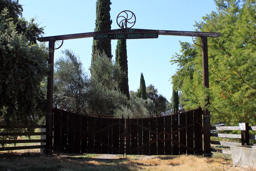
Photo: Chris Austin
27. The Delta's rich, fertile soil supports one of the most productive agricultural regions in the world.

Photo: Chris Austin
28. Over 90 agricultural products are grown in the Delta...

Photo: Chris Austin
29. ... including crops such as tomatoes, rice, strawberries, blueberries...

Photo: Chris Austin
30. ... corn, grain, alfalfa ...

Photo: Chris Austin
31. ... tree fruits, nuts...

Photo: Chris Austin
32. ... grapes, olives, and more.

Photo: Chris Austin
33. Since the Delta occupies the space between the Bay Area and the rest of the state, a lot of critical infrastructure must cross the Delta. Two major highways, I-5 & SR-99, cross the Delta on its periphery, and state highways 4 and 12 connect the Central Valley to the Bay Area.

Photo: Courtesy Department of Water Resources
34. Three major railway lines run through the Delta...

Photo: Chris Austin
35. ... and ships access the inland ports at Sacramento and Stockton through deep water ship channels, traveling nearly 80 nautical miles inland from the Golden Gate Bridge.

Photo: Courtesy Department of Water Resources
37. The Delta is a vital link in the state's utility infrastructure as well. Natural gas was discovered in the Delta in 1935. Today, the Delta serves as an important source of natural gas and as an important underground gas storage area.

Photo: Chris Austin
37. Electrical transmission lines cross the Delta. Some bring power to the Bay Area, while others carry power southward to cities and farms in Central and Southern California.

Photo: Chris Austin
38. There are many wind turbines here, positioned to take advantage of the frequent and reliable winds.

Photo: Courtesy Department of Water Resources
39. But perhaps the most critical infrastructure function of the Delta is acting as the hub for the state's water system, channeling freshwater from the mountains to reach the pumps of state and federal water projects.

Banks Pumping Plant, which draws water from the Delta for the State Water Project. This is the starting point for the California Aqueduct, seen at the very top. Photo: Courtesy Department of Water Resources
40. The pumps draw water from the Delta and send it south to irrigate the farmlands of the San Joaquin Valley, as well as to feed the faucets of Southern California.

The Bill Jones Pumping Plant, which draws water for the Central Valley Project. Photo: Chris Austin
41. Others draw freshwater out of the Delta, too. Municipalities and farmers living within the Delta also draw water directly from the Delta.

Photo: Chris Austin
42. And the Mokelumne Aqueduct and the Hetch Hetchy system divert water across the Delta to quench the thirst of the Bay Area communities.

Photo: Chris Austin
43. All in all, about two-thirds of the state's population and millions of acres of farmland are dependent upon the Delta, at least in part, for their water. Many more affect the Delta by drawing water upstream, taking water that would have otherwise flowed into the Delta.
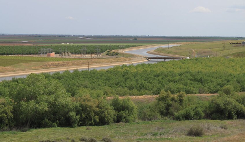
Photo: Chris Austin
44. And while the Delta is a beautiful and peaceful place, its delicate ecosystem is in trouble.

Photo: Chris Austin
45. The Delta looks nothing like it did before it was remade to suit the society's purposes, and so, unsurprisingly, native species have struggled to adapt. Some native species have already gone extinct, and several more are endangered, including the spring-run and winter-run Chinook salmon, and the Delta smelt, pictured here.

Photo: Courtesy Department of Water Resources
46. Operations at the water projects have been subjected to limits and shutdowns imposed by the court in order to protect endangered species.

Skinner Fish Facility. Photo: Courtesy Department of Water Resources
47. While the existing water-supply operations have certainly had profound impacts on the Delta, changing the natural flow patterns and even reversing the direction of the rivers at times, there are many other potential factors involved in the Delta ecosystem's collapse.

Photo: Chris Austin
48. The Delta estuary has been named as one of the most invaded estuaries, with over 250 introduced plant and animal species now flourishing, much to the detriment of the native species.

Photo: Chris Austin
49. Water quality within the Delta is a big issue. An extensive network of drainage ditches keeps the Delta islands from flooding. Many farms are allowed to discharge this drainage directly into the Delta, flushing pesticides and fertilizers into the waterways.

Photo: Chris Austin
50. And some municipalities discharge their stormwater and treated wastewater into the Delta.

Photo: Chris Austin
51. Freshwater flows are needed to keep saltwater from intruding into the Delta, and to flush out pollutants. The biggest argument is over how much water can be drawn from the Delta and still have a healthy ecosystem. Nobody really agrees on how much can be drawn or who should be forced to take less.

Photo: Chris Austin
52. No one agrees on just what is causing the collapse of the ecosystem. Excessive water diversions? invasive plants or species? Agricultural drainage and pollutants? Something else? These problems must be solved if water exports are going to continue.

Photo: Chris Austin
53. In 2009, the state of California passed legislation that says the goals of ecosystem restoration and water supply reliability must be treated equally, with neither favored over the other. The courts have already intervened in water supply operations; it is increasingly apparent that if the state cannot solve the problems in the Delta, there will only be more court intervention in the future.
Photo: Chris Austin
54. Another major concern is the condition of the levees. In the Delta, the levees both provide flood control and act as channels to convey water to the pumps in the Southern Delta for export to the San Joaquin Valley and Southern California.

Photo: Courtesy Department of Water Resources
55. Delta levees, like any other levee, aren't fail proof; some would say it's a matter of when, not if, the levee will fail. Since the 19th Century, each of the islands and tracts has flooded at least once, several of them more than once. There have been about 100 levee failures since the early 1890s.

Photo: Courtesy Department of Water Resources
56. The last levee break was at Jones Tract in 2004. The levee was repaired at a cost of $90 million.

Photo: Courtesy Department of Water Resources
57. It's an expensive process for the property owners; several of the islands, like Liberty Island, have simply been abandoned after being flooded.

Photo: Chris Austin
58. Most of the Delta islands are sinking at a rate of 1 to 3 inches per year, with many islands already between 10 to 25 feet below sea level. The dominant cause of this subsidence is the decomposition of organic material in the rich peat soil. This subsidence increases the pressure on the aging levees.

Graphic: Courtesy USGS
59. In this picture of Twitchell Island, you can see how much lower the land is compared to the level of water in the channel.

Photo: Courtesy Department of Water Resources
60. Several earthquake faults run under or near the Delta, and seismic risk to the levees is a major concern. A massive earthquake could potentially cause multiple levee failures and draw salty water from San Francisco Bay deep into the Delta, jeopardizing the fresh water flows that much of California's population and agriculture depends on. Repairs could cost billions and take anywhere from 6 months to 2 years.

61. Add in the effects of climate change -- rising sea levels and more extreme weather events -- and it seems quite likely the Delta of the future won't look like the Delta of today.

Photo: Courtesy Department of Water Resources
62. People have been fighting over the Delta for years: farmers (both inside and outside the Delta), fishermen, environmentalists, state and federal agencies, water agencies, and Delta residents.

Photo: Courtesy Department of Water Resources
63. Many attempts at problem solving have met with dismal failure. Everyone agrees there are problems; but no one really agrees on the extent of those problems or what exactly should be done about them.

Photo: Courtesy Department of Water Resources
So there you have it, the Delta in a nutshell -- although the story is quite complex and there's a lot more to it than can be covered in this simple post.


