L.A. River Excursion: Five Stops Along the Lower Half

Last Sunday nearly fifty pairs of fresh eyes came to see the Los Angeles River for the first time, to discover its various forms, to learn what it once was, and imagine what it one day might be. Throughout the year HiddenLA, a Facebook group with nearly a quarter million fans, with advocate, urban ranger, and environmental writer Jenny Price, organizes guided tours along various sections of the Los Angeles River. For this day, Angelenos got to play the part of tourist, exploring their city's most under-utilized resource.
Keep exploring the L.A. River


This being the first morning of Daylight Saving Time, "tourists" slowly rolled into the Los Angeles River Center with tall cups of coffee in hand. Once a Lawry's Steakhouse, the center is now home to Friends of the Los Angeles River and the Mountains Recreation and Conservation Authority. Liability forms were signed, carpools assigned, and logistics coordinated to move this group, one of the largest this tour has had, along 25 miles of the river to visit five different sites with two pit-stops.
Glendale Narrows
We were first taken to the Glendale Narrows (in Atwater), where the river actually looks and smells like a river, contrary to popular belief. A blue heron was instantly spotted, along with a great egret, muscovy ducks, mallards, canadian geese, and coots. Tourists pointed their cameras at the "green isles" - rich vegetation in the center of the soft-bottom channel, where cottonwoods and willows grow. From a small pedestrian bridge we took in the landscape, with Griffith Park rising in the distance and the Los Feliz Bridge cutting across the river.


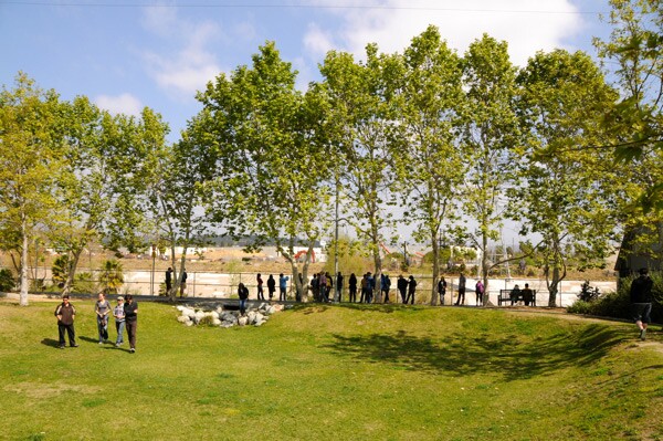
Marsh Park
Continuing on, we stopped at Elysian Valley's Marsh Park, the first clean water park along the river. A drain at the entrance pulls water through an underground tunnel into the lowered portion of the park, allowing water to percolate into the ground, filtering toxins from runoff and eventually replenishing deep underground aquifers.
Confluence
At the confluence, we took off our shoes off and soaked our feet. Here, where the Arroyo Seco meets the Los Angeles River, the city of Los Angeles was born. Now it's a corridor of transportation: freight trains, Metrolink, and in the distance, Metro, add to the noise of the freeways. Still the sound of running water stands out, as it streams between our toes, intertwining with strands of algae.


Sixth Street Bridge
We took in the underside of the Sixth Street Bridge through an access tunnel. Once large spans of graffiti - a hall-of-fame of sorts - covered the cement banks. But now all that remains are blocks of various tinted paints covering the marks. This will soon to become just a memory - designs are now being drafted to replace the decaying bridge, likely to collapse under stress from an earthquake.


Maywood Riverfront Park
Following a buffet lunch at Boyle Height's Taqueria El Sol, we visited Maywood Riverfront Park. Formerly a superfund site due to contaminates from the former Pemaco Maywood chemical mixing plant, the site has been renovated with a 3.5-acre park, serving one of the park poorest communities in Los Angeles. A 12-mile bike path crosses the park, starting from El Monte, ending in Long Beach.


Dominguez Gap
As the end of the day drew near, we grabbed raspados and hit the last spot: the Dominguez Gap Wetlands, where the vegetation has grown in considerably in the four years since breaking ground. Just over the ridge, however, expansive slabs of cement and large structures with spanning power lines run parallel to the river's path. Still, sitting on slope on the cement bank, looking at the endless space as the sun was setting, it seemed oddly just as beautiful as the Narrows.


Check back every week for more L.A. River Excursions


