East Side Trail Extension
Current access to the Los Angeles River in the NELA Study Area exists along the west side of the River and in portions on the east side of the River, via the Los Angeles Greenway Trail. While the current formalized narrow, paved pathway on the west side is striped for two-way pedestrian and cyclist use, its implementation has posed a problem for pedestrian seftey and ease-of-use. While pedestrians and cyclists traverse the informal maintenance road and river channel located on the River's east bank, there is currently no formalized or legal pathway established for such activity on the east side of the River.
Creating a formalized multi-use, shared trail predominantly for pedestrians with some cyclist access along the east side of the Los Angeles River as well as access on the east side borrowing from conditions employed in Elysian Valley, will increase access to the River and recreational opportunities for NELA residents. The proposed trail expansion would connect the existing Greenway Trail in Atwater Village north to the Glendale Riverwalk and extend access south from Fletcher Drive down through the Lincoln Heights neighborhood.
In its initial phase, the project proposes to mirror the improvements made to the West Side Trail beneath Fletcher Boulevard, creating a safe and continuous path, as well as provide opportunities for riparian planting through a series of river terraces. This re-routing will allow for existing automobile traffic to remain intact, while simultaneously allow East Side Trail users to enjoy uninterrupted walking, jogging, and bicycling.
Essential amenities that are currently limited and/or lacking along the existing Los Angeles River Greenway Trail will be incorporated into the East Side Trail Extension. Such Trail improvements include, but are not limited to: seating, water fountains, plantings, rest room facilities, lighting, signage and safety call boxes.
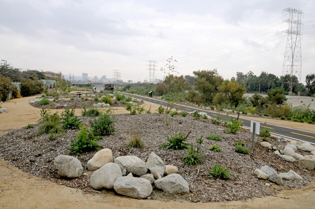
Small squares, public art works and waterfront decks will also be located at regular intervals along the River to increase the amount of usable space for resting and relaxing along the river banks. Incorporating plantings of native vegetation along the riparian corridor will also be a focus of the East Side Trail Expansion, and aim to improve both the ecology and visitor experience along the Los Angeles River.
The East Side Trail Extension will provide a north/south connection on the Eastside of the River as well as connect into surrounding neighborhoods in the NELA study area via public streets and open spaces. Linking the Los Angeles River to surrounding neighborhoods and open spaces will achieve a more robust and contiguous matrix of green and open space in Northeast Los Angeles. Establishing a larger connected network of access will be achieved by working with the City of Los Angeles' related programs, such as Mayor Garcetti's Great Streets and Green Streets Initiatives. Additionally, the Rio Vistas project, managed by the L.A. River Revitalization Corporation, is realizing more opportunities for connections.
The number and quality of access points from neighborhoods and streets to the River will also be increased through the East Side Trail Extension project. Opening up dead ends of streets, and providing more formalized entryways to the river and trail will be a large focus of the project. Signage and other way-finding mechanisms will be used to increase the awareness that the River and trail exist, and assist Angelenos
navigating there.


