Goal 4: Improve Ecological Health of the Built Environment

Build a distinct identity and strengthen a sense of place within each local neighborhood.
Protecting, restoring, and connecting the River to the built environment network that surrounds it maximizes the ecological health of this community.
Policies and programs that minimize the adverse impact of toxic uses and impermeable services are essential to a healthy Riverfront.
The River can only provide social and recreational opportunities if advances in the environmental quality of the River continue, a threshold inextricably linked to the built environment surrounding it. The environmental health of the River is dependent on the sources of ground contamination, surface water contamination, and toxic sites adjacent to the River.
The advances in environmental strategies in the built environment also have a direct impact on the overall public health of its residents. Understanding the connections between various environmental conditions, its impacts, and the range of strategic solutions will enhance the overall health and sustainability of the Riverfront District.
Although the City has created a network of green tools, such as green street initiatives and building measures, that collect stormwater run off and minimize toxic outputs, much more can be done. The following objectives highlight a range of approaches that have great impact potential.

Objectives
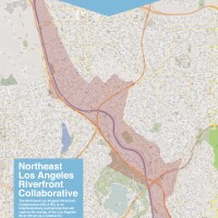
A. There are three major areas within the NELA Study Area with identified Hazardous and Toxic Waste Contamination (HTRW). These sites include the San Fernando Valley Superfund site, immediately north of the Study Area and currently being remediated with oversight by the EPA. The next two sites is Taylor Yards, a 243 acre rail yard that has been used for 100 years with two specific sites (GI and G2) known for having elevated levels of lead and arsenic, as well as contaminants such as metals, volatile organic compounds, and petroleum products. Overall, there are 22 known and 1 likely HTRW sites within the Study Area
Although remediation efforts have satisfied human health standards for industrial properties, ecological or recreational standards have yet to be met. Despite investigations to identify HTRW sites of concern, it is possible that soil or groundwater contamination exists in the Study Area that has not been documented. The likelihood of contamination is most likely in sites that have former industrial use.

B. The water quality of the River is affected by point and non-point source pollution entering the tributaries and main River channel. Although 70% of the River's water volume enters from the Tillman Water Reclamation Plan in the valley, much of storm drain discharges arrive from the streets.
Stormwater runoff and its associated contaminants are from surrounded urban areas and the prominent source of water quality degradation. Specifically, runoff from surfaces, such as streets, parking lots, and lawns, carry an accumulation of contaminants that are washed directly into the River. Strategies to improve surface water quality, such as Low Impact Development, can mitigate stormwater runoff and serve as preemptive measures to flood management.
C. The development of green streets has the power to transform streets into a safe and efficient transportation network while also providing for storm water capture and remediation. Green streets transform impervious concrete and asphalt surfaces into landscaped, permeable green spaces that capture storm water runoff, use plants and soil to naturally filter water, and replenish groundwater supply.
In addition, green streets enhance the overall pedestrian and bicyclist experience with traffic calming measures. Streets which connect major nodes within the Study Area are best suited, especially streets that can be rebalanced to address the needs of traffic flow, transit services, and pedestrian/bicycle use. The implementation of a green street network will require ongoing streetscape improvements that consider the full range of traffic flow, as well as drainage and filtration potential.


