Five Secret Desert Places To Visit This Year Instead of Joshua Tree

Let's face it: Joshua Tree National Park has been discovered. More than 2.5 million people visited Joshua Tree in 2016, an all-time record, and the Park and its surrounding communities are feeling the strain. Nearby towns do benefit economically from high numbers of visitors, but there are also negative effects ranging from unavailable local housing (as houses get bought up by prospective AirBNB operators) to delays in emergency services to houses near the Park; those hour-long lines to get through the gate can mean an ambulance, or even just the emergency plumber, won't get to your place anytime soon.
And then there's the crowds' impact on the park. With inadequate parking at popular stops, more and more of the Park looks like this time-lapse video shot at the Hidden Valley picnic area by the National Park Service's Hannah Schwalbe:
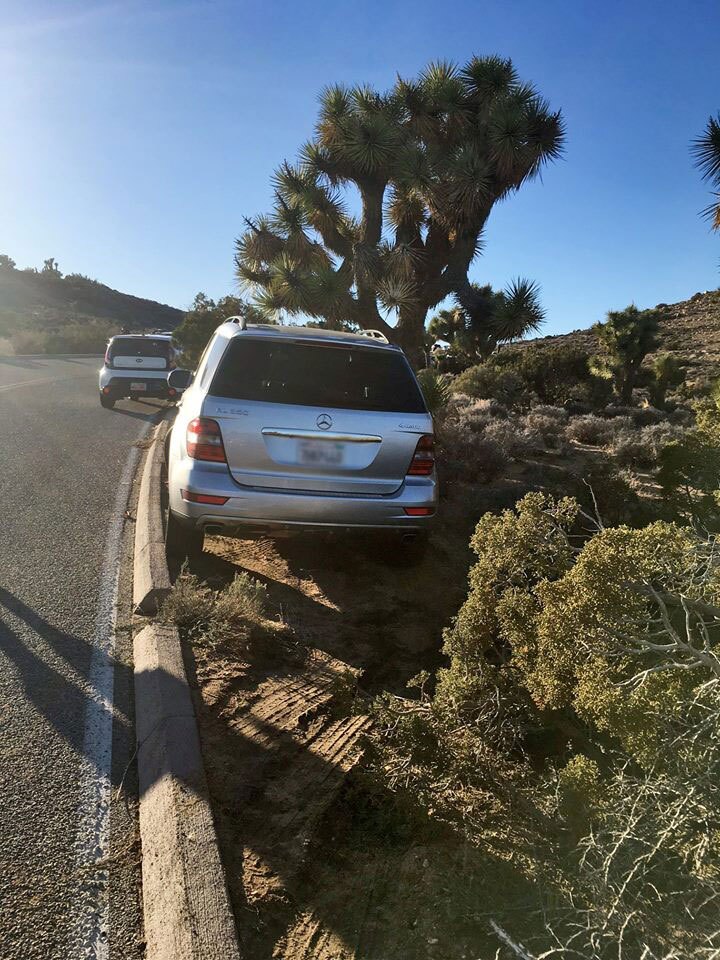
And sadly, some visitors have responded to the shortage of parking places by trying to make some of their own, causing damage to the desert vegetation that will take decades to heal — if other visitors don't see the tire tracks on the wrong side of the curb and decide to follow suit.
Perhaps most of all, the crowds erode much of the reason true desert lovers go to the desert in the first place: quiet, wide open spaces; a chance to get away from the mass of humanity for a bit; the chance to see desert plants that haven't been parked on and wild animals that aren't in campgrounds begging for peanut butter sandwiches. For desert rats, who are more interested in experiencing the real desert than in being seen at the uber-stylish music video backdrop resort du jour, a Joshua Tree visit in season has become something to avoid at all costs.
Fortunately, there are a lot of other places in the California desert that beckon, and many of them are little-known enough that you might well find you have the place to yourself.
(And before you object that I'm changing these places' uncrowded nature by writing about them: I've written about them before, for several years. They haven't been overrun. The forces of conformity pushing people toward Joshua Tree National Park are hard for the masses to resist.)
A note on preparation: Assume you're on your own in most of these places. bring enough water for everyone — a gallon per person per day in the winter — as well as abundant food, sunglasses, hats, and warm clothing. (Winter in the Mojave is unpredictable.) And make sure your car is in good shape, able to tackle the challenges the desert offers.
Mojave Trails National Monument
Twice the size of Joshua Tree National Park at 1.6 million acres, Mojave Trails was one of three National Monuments created in the California desert by former President Barack Obama in February 2016.
It has very little in the way of amenities. You may be lucky enough to happen by Roy's in Amboy when the place is open and serving burgers. Otherwise, you're pretty much on your own. Make sure you stock up on food, water, firewood, and gasoline in Twentynine Palms or Barstow on your way in.
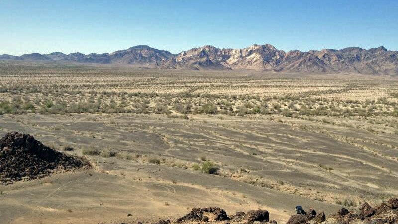
Once you get there, though, Mojave Trails more than makes up for in awesomeness what it lacks in civilized comforts. From black cinder cones to sand dunes, historic highways to Native rock art, this "little" patch of the Mojave north and east of Joshua Tree is the best the desert has to offer. Of special importance: you can find yourself on a dirt road 10 miles off the pavement and see no one else for hours, or sometimes days, s the sun sets and the sky goes from pink to purple.
No campgrounds: dispersed camping is allowed through most of the Monument. Check with the BLM for rules and regulations: they can provide you with maps, as well as information on which roads are easy to travel, and which will swallow you up in deep sand never to be seen again.
You can also find useful information about Mojave Trails and other desert monuments at the website of the Mojave Desert Land Trust, which has set up a Mojave Monuments adventure kit.
Castle Mountains National Monument
Pretty much everything said above about Mojave Trails NM applies to the Castle Mountains, a corner of the northeast Mojave left out of the 1994 boundaries of the Mojave National Preserve. You're on your own out here, hard up against the Nevada state line; bringing a trusty vehicle and abundant water will make your visit the kind of adventure you'll be able to tell people about later.
Amenities are available, sort of, in the nearby towns of Nipton, California, and Searchlight, Nevada. (Don't expect to find kombucha or gluten-free baked goods in either place.) Access is either by way of the road between those two towns, entering the Monument on Walking Box Ranch Road, or from the Lanfair Valley area in the Mojave Preserve. Jeep trails are numerous and not always represented on the map, so your route-finding skills will come in handy here.
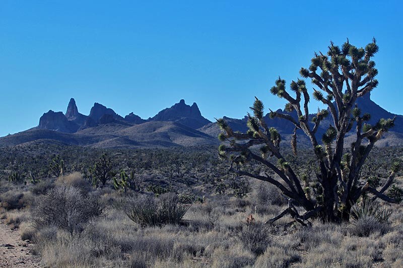
Once here? You'll see a mix of Joshua tree forest, Mojave yucca-studded grasslands, and imposing cliffs of volcanic rock. You'll also get a good view to the west of the Castle Peaks in the Preserve, which aren't the Castle Mountains even though their photos grace most websites mentioning this new National Monument. (Including this one. We're not proud.) Look for interesting barrel cacti, mesquite bosques in the washes, petroglyph panels and eagles. This part of the desert has more golden eagles per square mile than anywhere else I've experienced.
Palen-McCoy Ironwoods
Get yourself into a trusty high-clearance vehicle, preferably 4WD, stocked with water and everything else you'll need. Go to the Lovekin road exit off Interstate 10 in Blythe. Head 5.3 miles north and veer left onto (paved) Midland Road. From there, proceed 12.29 miles to Arlington Mine Road, a dirt road heading off to the left that may not be marked — or there may be a sign reading "Inca." From there — you did bring a detailed map printed by the BLM, right? — follow either Arlington Mine Road or the parallel and confusingly named Arlington Road about 10.5 miles west, choosing whichever of the two roads seems in better shape. (They cross a couple times. Don't ask me.) The roads cross alluvial slopes of rocks coated with desert varnish, several washes lined with trees, and a maze of smaller off-road vehicle tracks. At around ten and a half miles from Midland Road, a T intersection presents itself as you begin to crest a small rise of dark rock. Take the right-hand, downhill choice, which might be marked "Arlington Mine Road." In about a mile you'll reach a wash lined with desert ironwoods, Olneya tesota, one of the vegetative marvels of the California Desert.
The view to the south has changed a little since I was first here in the early 1990s: 12 miles away in that direction is the Genesis Solar power plant, whose nighttime security lights will intrude somewhat into your night sky viewing. So set up camp facing north. Watch for coyotes, desert kit foxes, phainopeplas (a little dark crested bird that frequents mistletoe), roadrunners, and the slowing of your own pulse loud in your ears.
But mostly, just sit and watch the ironwoods grow their few millimeters a year.
Given the directions above, it's no surprise that this spot has remained unfrequented by trend-seeking crowds despite its mention in the grandmother of all California desert camping guides, Lynne Foster's Adventuring in the California Desert, first published in 1987. That means you're very likely to have the place all to your lonesome. It also means be sure there's air in your spare.
Arthur D. Ripley Desert Woodland State Park
Here's a spot at the other end of the spectrum: it's not only unremote — on a paved road just 80 miles from DTLA — but it's small. At 566 acres, you could drop this little-known State Park into a nook in the border of Mojave Trails and no one would notice the change.
But for a desert day trip offering the promise of solitude, it's hard to beat this little Antelope Valley park. Five miles west of the more popular Antelope Valley Poppy Reserve, the Ripley Woodland protects some of the state's most-endangered desert habitat: the Joshua tree-California juniper woodland that once covered most of the valley.
Amenities include pit toilets and a picnic table with a ramada overhead. There are two short hiking trails: one, a quarter-mile long, leading through a forest of Joshua trees, junipers, and buckwheat, and another a full mile in length, highlighting the junipers in the area. Incongruous plants such as cheesebush and Hesperoyucca whipplei grow here as well.
You may be getting the impression that there isn't a lot of wide open uninhabited space to be found here. You'd be correct. But with visitation as light as it is here — I've been a few times and never seen anyone else there that didn't come with me — you may be able to get a few hours of desert solitude in just the same.
Centennial Flat
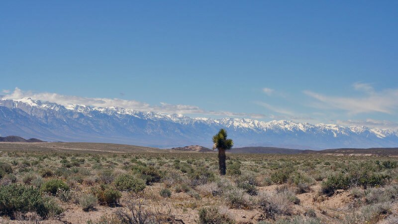
A fair amount of the attention Joshua Tree has gotten as a hip Mecca is due to a certain 1980s-era album of the same name. But true desert aficionados know that the oversubscribed National Park and the U2 album have precious little in common aside from the name. Bono, The Edge, et al may well have visited what was then Joshua Tree National Monument back in the day, but the album's iconic photos of a desert landscape sparsely studded with J-trees were shot (in 1986, by Anton Corbijn) more than 160 air miles north, on a desolate plain between Lone Pine and Death Valley.
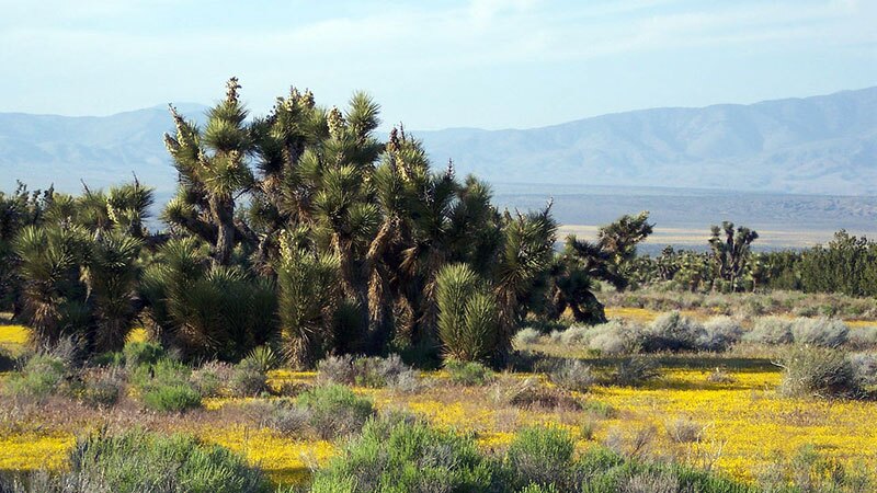
That plain — Lower Centennial Flat in Inyo County —is still desolate, if you take desolate to mean "devoid of boutiques and traffic jams." The big, contorted Joshua tree featured in the Corbijn photos died sometime around the turn of the century, but the rest of the valley is much as Bono and the boys saw it back during the carefree days of the Carter administration. There's the Coso Range as a multihued mountain backdrop in one direction, and the High Sierra in the other. There are Joshuas here and there across the landscape. There's a carpet of diverse desert shrubs and grasses stretching for miles, with bare mineral soil between them that host displays of spring wildflowers when the rains are sufficient. (They have been, so far, in the winter of 2016-17. Word to the wise.)


And there are thousands of acres of BLM land, open to your landscape-sensitive dispersed camping desires.
It's important to note that this is an open plain, with little in the way of windbreaks or shelter from sun: you are really out in the open here. Temperatures range from searing to cryogenic. I've done well here by tying a tarp to the downwind side of my vehicle for a bit of shelter from the elements.
Being a big, wide open plain, you might be at a loss once you arrive as to just where to camp. Try this: Starting from Lone Pine, the nearest source of provisions, take Route 136 east around the far shore of Owens Lake. (You would do well to stop at the interagency Visitor Center at the junction of 395 and 136 to get maps and ask for advice.) In about 17.5 miles, you reach the junction with State Route 190. Don't turn: proceed straight ahead on what is now eastbound 190 for another ten miles. You'll see a dirt road crossing the highway, with a wide spot suitable for parking on the right.
This is where most people visiting Lower Centennial Flat get out of their cars. That's because the iconic old Joshua tree from the album cover photos lies dead just a short walk away. (I won't spoil it for you by giving precise directions, but I can assure you that if you get there, you'll know you've found what you're looking for.) Once your curiosity is satisfied, head southwest on the dirt road, which should be marked on your map as Centennial Road. Get a few miles off the pavement. Find a wide spot along the road where you can safely pull off without getting stuck or crushing desert vegetation. Set up camp.
You'll almost certainly have the area to yourself at night, and quite likely during the day if you choose the right day. You'll have amazing 360 degree views, near silence, and the smug satisfaction that you found a place that's hipper than Joshua Tree, though perhaps with fewer artisanal kale wraps.


