Sweeney Ridge and the Accidental Discovery of the San Francisco Bay

…our Commander determined to continue the journey in search of the harbor and vessel of which the scouts had been informed by the heathens, and in the afternoon we set out…going along…the shoreline…until we took to the mountains on a northeast course. From their height we (saw) the great estuary… -- Miguel Costansó, Nov. 5, 1769
I underestimated the climb. For some reason, I thought the hike up to the San Francisco Bay Discovery Site in San Mateo County would be a breeze, an afterthought. This assumption was wrong.

I panted up the dusty, steep trail, in jeans and a long sleeved t-shirt, which I soon stripped off, revealing my one and only sports bra. When I reached the one mile-marker, I almost cried -- I was sure I had already hiked at least two miles. As I ascended higher, the view became breathtaking and the scrubby vegetation more impressive -- yellow and red wildflowers, poppies, a plateau of fir trees. After 2 ½ miles of frequent stops, I reached the top of Sweeney Ridge, about 1,220 feet above sea level.
Teenage boys were smoking pot on the only bench, so I stood and took in the majesty of the San Francisco Bay, spreading out in front of me, like a giant inviting pool. Farther up a smaller trail I found a monument, a hunk of rough stone in a field of brown dirt. It read, “From this Ridge the Portolá Expedition Discovered the San Francisco Bay November 4, 1769”
None of the other hikers on the trail ventured up to the secluded monument -- few even seemed to know it was there. I sat and caught my breath on the cement block that held the monument in place, pouty and bummed that I still had to hike back down to my car. I reflected on the fact that when Gaspar de Portolá had reached this daunting ridge over 200 years ago, he had also been bummed out -- for another, more pressing reason.
He had not found what he was looking for.
In May 1602, a self-funded Spanish explorer named Sebastián Vizcaíno set out to explore the coast of what is now California for the viceroy of New Spain. “Vizcaíno and [his] company were to chart and sounds, bays, islands, reefs and bars,” a report from the National Parks service states. “They were to take solar and stellar readings, note wind directions, map locations of anchorages, reference wood and fresh water sources and establish place names with their topographical descriptions.” Vizcaíno was particularly interested in discovering safe harbors, which could host treasure ships from the Philippines. When he reached Monterey Bay on December 16, he believed he hadfound a perfect harbor, “sheltered from all winds.” News of his discovery spread in New Spain, and the utopian harbor of Monterey became a legendary find.
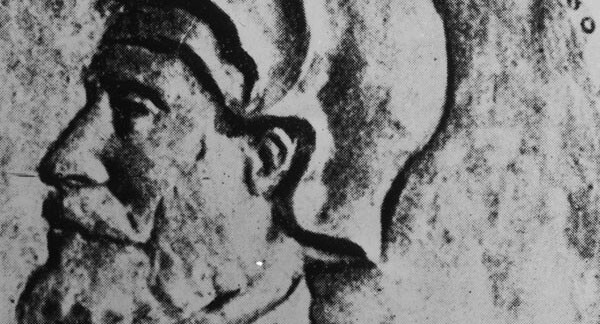
Over a century passed. The Spanish were slow to explore the coast further, consumed in the governance of other parts of their empire. In 1767, Gaspar de Portolá, a sophisticated 50-year-old career army officer from an aristocratic Catalan family, arrived in New Spain, posted to duty in the “Army of America,”-- a post he did not ask for.
By 1769, the Spanish were finally ready to begin occupying California. A “sacred expedition” on land and sea was organized, and Portolá was appointed its leader. A group of 300 explorers, including 27 Calvary officers, soldiers, Christianized Mexican Indians, blacksmiths, carpenters, engineer Miguel Costansó, and an army surgeon were assembled, and set out on foot for San Diego. Also in the party were the legendary Franciscan Father Junípero Serra, considered the father of the controversial California mission system, and his associate, the astute and literary Father Juan Crespí. Three ships -- the San Jose, San Antonio, and San Carlos -- were to provide food and materials to the land party throughout their journey.
When the land party reached San Diego their number had been cut in half, decimated by illness and exhaustion. The surgeon had lost his mind. When the San Antonio and San Carlos arrived, their crews were not much better off, having been ravaged by scurvy.
Portolá, joined by 64 men, including Father Crespí and engineer Costansó, left San Diego on July 14, 1769. Father Serra stayed in San Diego to establish the first California mission and care for the ill. Portolá and his men ventured farther north on foot and donkey, clearing a trail that would later be known as the El Camino Real. They were searching for Vizcaíno’s mythical Monterey Bay. They were also on the lookout for the San Jose, which was supposed to meet them at Monterey with life-saving provisions.
It was an exhausting journey. The men traveled hundreds of miles, through present-day Los Angeles, Santa Barbara and San Simeon, while scurvy sapped their strength. Supplies were running low and their maps, drawn up by the Vizcaíno expedition, were inaccurate, complicating matters further. When they came across a large bay on October 1, they explored it for two foggy days, and decided it could not possibly be the epic Monterey Bay of Vizcaíno’s description. Not only was it just an ordinary bay, the San Jose was nowhere in sight. Unfortunately, they were incorrect -- the bay was indeed Monterey.

And so they traveled on, searching for what they had already found. In late October, Portolá met a group of Quiroste Indians near the edge of southwestern San Mateo County. The Quiroste told them that close by were two harbors, and in one of those harbors was a foreign ship. The party was thrilled -- finally they would find both Monterey Bay and the missing San Jose. “The ship is there,” Father Crespí wrote. “Divine Providence grant it be so, and that we reach there as soon as can be.”
On November 3, a portion of the party went up what is now Sweeney Ridge. They returned that evening, firing their guns in celebration. The men had come upon seven native villages, and most importantly, a “great estuary” where Native Americans again claimed a ship was located. The next day Portolá and the rest of the expedition climbed up an old Indian path to the ridge, to see this great body of water for themselves. Atop Sweeney Ridge, they beheld the San Francisco Bay. Father Crespí wrote in his diary about the day of discovery:
We celebrated this day in honor of San Carlos, the patron of the royal presidio and mission to be founded at the port of Monterey, and also in honor of our king, Don Carlos III (whom God keep) by performing the holy sacrifice of Mass in this little valley, on the beach of the harbor, without the least doubt, of my Father San Francisco. About one in the afternoon we set out to continue the journey, following the beach to the north. We then entered the mountains, directing our course to the northeast and from the summit of a peak we beheld the great estuary or arm of the sea, which must have a width of four or five leagues, and extends to the southeast and south-southeast. Keeping it always on the left hand, and, turning our backs to the bay, we took a valley open to the south and southwest. After three hours' travel in which we made two leagues, we halted in a valley at the foot of a mountain range covered with low, very green woods, and having near the camp a grove of live oaks on the west slope of the mountains.
While Crespí and other observers were understandably impressed by the great estuary, their commander was decidedly not. They had not found the San Jose, stocked with life-saving provisions. “We traveled three hours, all of it bad road,” Portolá wrote. “Stopped with no water.”

Portolá was fed up. After a few more days exploring the area around the bay, he ordered the party to turn south, therefore missing out on the discovery of the “golden gate” strait, which connects the Bay to the Pacific Ocean. As the party trudged back to San Diego, they were almost universally disappointed in their finds, unimpressed by what was in fact Monterey Bay, even on second sight. And the San Jose? It was never found, another ship lost to the turbulent sea.
Only Father Crespí and a few other soldiers seemed aware of what they had found. Back in San Diego, they told everyone about their discoveries. “It is a very large and fine harbor, such that not only all the navy of our Most Catholic Majesty but those of all Europe could take shelter in it,” Crespí wrote enthusiastically of the San Francisco Bay.
Their persistence and conviction paid off. In 1770, Portolá agreed to accompany Second Commander Pedro Fages, Costansó, Serra, and a handful of soldiers on a second expedition. The men painstakingly retraced the steps of the previous expedition. Gifted with better weather and clearer skies, they quickly realized that they had in fact discovered Monterey Bay, and a mission and presidio were established there by Father Serra that year. Encouraged, Portolá sent Fages farther north to explore the large body of water that the first expedition had viewed atop Sweeney Ridge. This time, Fages and his men explored the area more thoroughly. In their wanderings, they viewed the “golden gate,” and became aware of the bay’s enormous potential. Consequently, the San Francisco mission and presidio were established near the bay in 1776.
Gaspar de Portolá was never that impressed with any of his North American finds. “He thought that if the Russians really wanted this God-forsaken part of the world, of which he had grave doubts, that they should have it as a punishment for their aggressive ambitions,” an NPS history reports. He died in Lleida, Spain, in 1786, over five thousand miles away from the new society that his discoveries had made possible.

Further reading: "Historic Resource Study For Golden Gate National Recreation Area in San Mateo County"
Top Image: San Francisco Bay from Sweeney Ridge | Photo: Hadley Meares


