Photograph of intersection of Crenshaw Boulevard and South Leimert Boulevard, Los Angeles, CA, 1931.
Crenshaw and South Leimert Boulevard, 1931. | Dick Whittington Collection, USC Digital Library

17 Intriguing Photos of Crenshaw's Past

Support Provided By

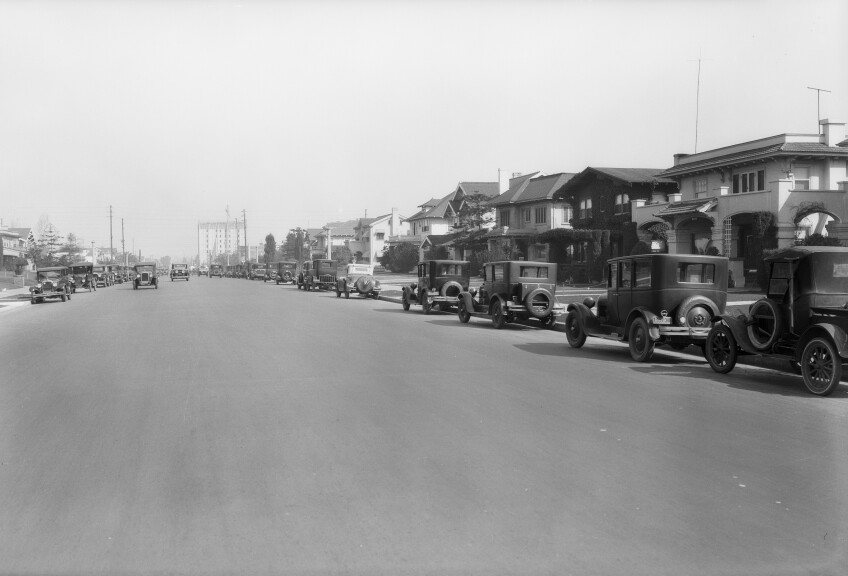
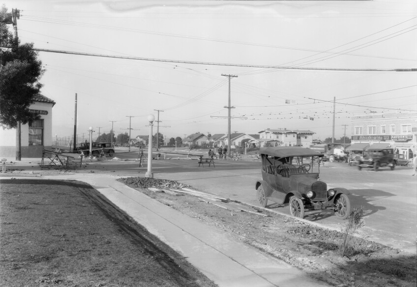
Photographers from the Dick Whittington Studio had a unique vantage point on the commercial development of Los Angeles and the transformation of major streets like Crenshaw Boulevard, which stretches 23 miles from Del Cerro Park in Rancho Palos Verdes through Hawthorne, Inglewood, Leimert Park, Crenshaw and Mid City to Wilshire Boulevard.

Since the studio was primarily hired by Southern California businesses — from corner markets to aircraft manufacturers, insurance companies and real estate developers — much is omitted from its photographers' visual record of Los Angeles during the studio's heyday between the 1920s and 1950s.

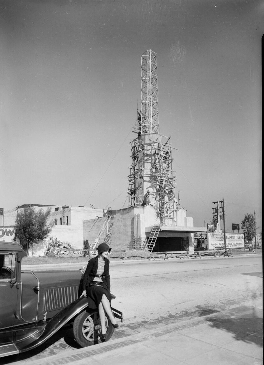
Some of the studio's most striking images reveal radical changes to L.A.'s streetscapes and built environment during this period. The photographers captured gleaming new gas stations, drive-up restaurants, the opening of a former Ralphs Market at Crenshaw and Rodeo Road 60 years ago on April 25th, 1942, and the construction of landmarks like Leimert Theatre in 1931.

An image of the 1942 Ralphs market with older cars in the parking lot on Crenshaw Boulevard and Rodeo Road.
The exterior view of Ralphs Market and parking lot on opening day at Crenshaw Boulevard and Rodeo Road, April 25th 1942. | Dick Whittington Collection, USC Digital Library
A woman with a hat eats and apple at the Ralphs market on Crenshaw Boulevard.
Actress June Storey at Ralphs Market at Crenshaw and Exposition, 1940. Storey co-starred with Gene Autry in ten cowboy movies during 1939 and 1940. | Dick Whittington Collection, USC Digital Library
Photograph of turnstile and groceries at M. Pynoos Market, Inglewood, CA, 1940.
Drinks for sale at the M. Pynoos Market at 9801 S. Crenshaw in Inglewood, 1940. | Dick Whittington Collection, USC Digital Library

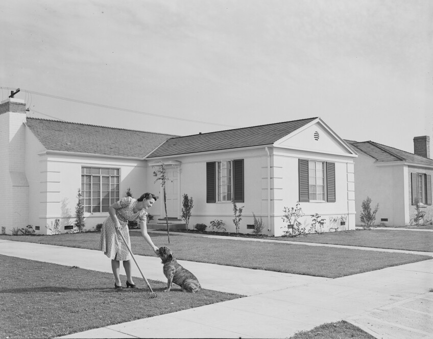
The studio's photographers also captured the wholesale construction and sale of new single-family homes at a scale that is difficult to imagine in the Los Angeles of today. Advertising $4,560 purchase prices, $460 down payments and $35 monthly mortgage payments, 1940s-era signs along Crenshaw Boulevard directed homebuyers to new developments like Crenshaw Manor, Crenshaw Park and Crenshaw Villa. Whittington photographers created staged promotional materials with models for these developments as they had done previously for upmarket developments with Spanish Colonial and Mediterranean style homes in Leimert Park and View Park during the 1920s and 1930s.

Crenshaw Boulevard between Exposition and Martin Luther King, Jr. Boulevard (formerly Santa Barbara Boulevard). A sign advertises homes for $4,560 with $460 down and $35 a month.
Crenshaw Boulevard between Exposition and Martin Luther King, Jr. Boulevard (formerly Santa Barbara Boulevard). A sign advertises homes for $4,560 with $460 down and $35 a month. | Dick Whittington Collection, USC Digital Library
Photograph of the on-site office of a housing development, Crenshaw Manor, Los Angeles, California, 1939 August 27.
Crenshaw Manor sales office, 1939. | Dick Whittington Collection, USC Digital Library

Missing from the photographs were the racial deed restrictions that prevented most nonwhite Angelenos from buying homes in these neighborhoods prior to the Shelley v. Kraemer ruling by the Supreme Court in 1948. After the ruling and thanks to efforts by key figures like U.S. Army 442nd Regimental Combat Team veteran and real estate agent Kazuo K. Inouye, Crenshaw and Leimert Park became popular destinations for Black, Japanese American and Mexican American families during the 1950s and 1960s.

The season finale of "Lost L.A.," "From Little Tokyo to Crenshaw," explores how new Crenshaw and Leimert Park residents forged identities and a sense of community and solidarity within their neighborhoods. As Scott Kurashige and Melissa Rovner trace in articles for KCET's "Lost L.A." series, these neighborhood identities have lasting and complex legacies today with the displacement of longtime residents and the disruptions of communities with the wave of real estate speculation through South L.A.

Building activity and homes in Crenshaw Manor, Los Angeles, CA, 1940.
Crenshaw Manor homes under construction, 1940. | Dick Whittington Collection, USC Digital Library
Crenshaw Villa, new small homes, Los Angeles, Calif., 1940
Crenshaw Villa homes under construction, 1940. | Dick Whittington Collection, USC Digital Library
Promotional photographs for the Crenshaw Park development, 1940.
Promotional photographs for the Crenshaw Park development, 1940. | Dick Whittington Collection, USC Digital Library
Photograph of woman sitting on automobile showing the Leimert Theater under construction in the background, Leimert Park, Los Angeles, CA, 1931.
Leimert Theatre under construction in 1931. The building was renamed the Vision Theatre in the early 1990s when it was purchased by actress Marla Gibbs. | Dick Whittington Collection, USC Digital Library
An aerial photograph of Leimert Park pre-development showing the Leimert Boulevard in View Park.
An aerial view of Leimert Park in 1929. | Dick Whittington Collection, USC Digital Library
Leroy's Sandwich Stand, Crenshaw and Jefferson, 1939. Art deco-type signage also has signs for Chicken, Fountain and Salads.
Leroy's Sandwich Stand, Crenshaw and Jefferson, 1939. | Dick Whittington Collection, USC Digital Library
A shingled building with a sign that says "P.K. Sandwiches." Additional signs include ice cream soda, hamburders, barbecue meat, homemade pies and thick, malted milk.
P.K. Sandwiches stand at Vernon and Crenshaw, 1930. | Dick Whittington Collection, USC Digital Library

Photograph of flooded street looking south on Crenshaw from Exposition, January 1930. In the foreground at right, a wide street can be seen beside a patch of dirt and vegetation at left. A large layer of water covers the road. At center, at least seven cars trudge through the water. Large waves churn beneath the tires of the automobiles. In the extreme background at center, additional automobiles can be seen. To the right, a row of small buildings are visible.
Flooded Crenshaw Boulevard near Exposition, 1930. | Dick Whittington Collection, USC Digital Library
Photograph of a block of 1600 Crenshaw Boulevard, Los Angeles, CA, 1928.
View of the 1600 block of Crenshaw near Venice Boulevard in 1928. | Dick Whittington Collection, USC Digital Library
The sidewalk at West 54th Street and Angeles Mesa Drive, later called Crenshaw Boulevard, which shows old-fashioned cars.
Sidewalk at West 54th Street and Angeles Mesa Drive, later called Crenshaw Boulevard. | Dick Whittington Collection, USC Digital Library
Aerial view of Crenshaw Boulevard facing South, Santa Barbara Ave (renamed Martin Luther King Jr. Boulevard).
Aerial view of Crenshaw Boulevard facing MLK Boulevard (formerly Santa Barbara Avenue) with Baldwin Hills in the background, 1954. | Dick Whittington Collection, USC Digital Library

The USC Libraries are nearing completion of a multiyear project to digitize 37,000 photographic negatives created by the Dick Whittington Studio during the 1930s and 1940s. The project was supported and made possible by a generous grant from the National Historical Publications and Records Commission (NHPRC). Support from the National Endowment for the Humanities (NEH) for a prior project enabled the USC Libraries to digitize 39,000 photographic negatives dating from the 1920s to 1930s.

Support Provided By
Read More
A sepia-tone historic photo of a man holding a cane standing in front of a food stand, surrounded by various crates, boxes, and advertising signs promoting cigarettes, candies, barbeque and more.

Pasadena Claims To Be The Home Of The Cheeseburger — But There's Beef

The cheeseburger was supposedly invented by Lionel Sternberger at The Rite Spot in Pasadena, when he added a slice of cheese to a regular beef burger and called it the "Aristocratic Hamburger." But the real history behind this fast food staple is a bit more complicated.
A hand-colored postcard of a large, white, colonial-style building with a green tiled roof stands behind a lush landscape of flower beds, a green lawn and many varieties of trees, with mountains looming just behind. An American flag waves at the top of a flagpole above the roof.

From Hiking to Hospitals: L.A. at the Center of the Pursuit of Health

The opportunity to get and stay healthy was a major draw for people to both visit and move to Los Angeles — whether it was during the tuberculosis epidemic (a.k.a. the "forgotten plague") during the 19th century or the health and wellness boom of the early 20th century. Both of these topics are explored in Season 6 of the PBS SoCal Original Series Lost LA.
A black and white photo of an adult dressed as the easter bunny with a giant costumed head, holding a little girl on their left who gives it a kiss on the cheek and, with his right arm, holding a little boy who brings his hands to his eyes as though wiping away tears.

Behold the Bunnies and Bonnets of L.A.'s Past Easter Celebrations

The onset of the spring season heralds the arrival of fragrant flowers in bloom — and all the critters that enjoy them, including the Easter bunny and families who anticipate his arrival with egg hunts, parades and questionable fashion choices.