An In-N-Out Museum and Underground Gardens: 10 Quirky Stops Along Highway 99

Highway 99 was a north-south thoroughfare that eventually extended from the Canadian border to the Mexican border — forming nearly 1,500 miles of the "Backbone of the Pacific States."
Officially designated in 1926, Highway 99 once functioned as "The Main Street of California" — running through major cities like Los Angeles and Sacramento and providing a crucial corridor for travel between them, especially across rough terrain like the Tehachapi Mountains.
Officials began decommissioning U.S. 99 starting in 1963, with new highways and freeways replacing it section by section. In 1993, some of the remaining bits and pieces were designated by the state of California as a "Historic Route."
But unlike "The Main Street of America," Route 66 — which provided an east-west passageway from Chicago all the way out to the Pacific Ocean — there hasn't been much mainstream nostalgia about Highway 99. It's rare to find signage along its old alignment — which means many modern-day drivers would have little way of knowing that it actually existed (much less where).
There are, however, some signs and traces of this seemingly "lost" California highway — many of which are in Southern California (or within fairly easy driving distance). Here are 10 of the best Highway 99 remnants that capture the character and charm of early 20th century "highway life."
1. Shields Date Garden, Indio

The southernmost terminus (or the southern "start," if you will) of Highway 99 is in Calexico at the site of the former Mexican border crossing, which was moved a couple of blocks to the west. You can see some signage just north of the intersection of East First Street and Heffernan Avenue — and from there, you can head north up Imperial Avenue (now Highway 111) to the 86, past the western shore of the Salton Sea, and into the Coachella Valley. Near the 111 juncture with the 10 Freeway, you'll reach the city of Indio, "The Date Capital of the Nation."
That's where you'll find 98-year-old roadside stand Shields Date Garden, with its heavenly neon sign of a Medieval knight hoisting a literal shield (circa 1953). Behind the building, there's a grove of date palm trees where they grow the fruits they sell in the store and café — both on their own and part of products like the infamous date shake. But as it's truly a travelers' paradise of a roadside attraction, it also boasts a free film screening (The Romance & Sex Life of the Date) and a walk-through garden with statuary.

On your way, be sure to stop at Clark's Travel Center — "The Oldest Operating Truck Stop on Historic Route 99 From Canada to Mexico," established 1947 — at 82253 Indio Blvd., where you can see a U.S. 99-themed mural on the exterior wall. Time your trip through Indio just right (that is, in February), and you'll be able to also hit up the Riverside County Fair and National Date Festival, held at the Riverside County Fairgrounds along the 111 more or less continuously since 1938.
2. Euclid Avenue, Ontario


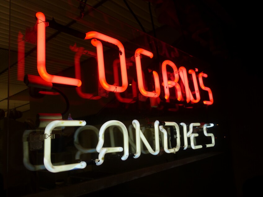

There are several points of interest along Ontario's Euclid Avenue near its original intersection with Highway 99 (now Holt Boulevard, a.k.a. "A Street") — like Logan's Candies (since 1933, featuring the World's Largest Handmade Candy Cane). Take a look at the north side of the Granada Theatre building on Euclid at C Street, and you'll see a vintage sign advertising Historic Route 99 as "The Original Ocean to Ocean Highway" in Old Towne Ontario.

Just south of this historic intersection, you'll find the Ontario Museum of History and Art, located in Ontario's former city hall (circa 1937). Across from the Granada, there's also the Woman's Christian Temperance Union (WCTU) drinking fountain, which was installed at Euclid and A Street in 1908 to encourage people to drink water instead of booze. (It was relocated a couple of blocks north to its current spot in 1975.) The historic "Mule Car" display on Euclid just south of B Street is a replica (created by "a couple of prop guys from MGM studios") of the public transportation system that used to run down Euclid from 1888 to 1895.
And don't miss some Historic Highway 99 eats nearby on Holt Avenue — like the former Grinder Haven (a glorious mid-century roadside food stand that's now operating as Tacos Estilo Guadalajara) and the original location of Vince's Spaghetti (circa 1945).
3. Original In-N-Out, Baldwin Park

In 1965, the completion of the 10 Freeway (a.k.a. the San Bernardino Freeway) essentially replaced Highway 99 — and that includes obliterating the first outpost of the burger chain In-N-Out (circa 1948), located near the intersection of Garvey Avenue and Francisquito Avenue in the San Gabriel Valley city of Baldwin Park. There are bits of Garvey Avenue that still exist today, mostly as a frontage road — but they're actually not the original alignment of Garvey, which was covered by the 10 Freeway.
Close to that original location is a replica of the first store — a drive-thru burger stand — and mini-museum devoted to In-N-Out, located under the shadow of the 10 Freeway at 13766 Francisquito Ave. It opened in 2014 and welcomes visitors Thursday through Sunday between 11:00 a.m. to 2:00 p.m. Next door, you can also pick up some branded swag at the In-N-Out Company Store (13800 Francisquito Ave.).

4. Gay's Lion Farm Site, El Monte

Where the 10 Freeway exits at Valley Boulevard in El Monte, you'll find a commemorative marker of the site of the former Gay's Lion Farm, which operated between 1925 and 1942, right alongside the path of what was to become Highway 99 in the 1930s.
Although a lion statue is all that's left of the roadside attraction — raw meat to feed the real-life lions got too expensive during World War II, and the animals were relocated to zoos — it's still a worthy stop reminiscent of a bygone era. (Head south of the 10 Freeway and the old Highway 99 alignment to El Monte High School, near the El Monte Historical Museum, to see an original bronze statue of a lion from Gay's Lion Farm.)

Another quirky destination along Valley Boulevard is "Lady Liberty," a 22-foot-tall miniature Statue of Liberty replica dedicated in 1987 as part of El Monte's 75th anniversary. It's located in the Centennial Liberty Garden, dedicated in 2012.
5. Pink Motel, Sun Valley

Although Highway 99 did once cross through the city of Los Angeles, you'd be hard-pressed to find any sign or mention of it anywhere within city limits. Even where it crossed or overlapped with Route 66, this historic highway has been lost to progress and development — including the construction of even more freeways, including the 110 and the 101.
But head to the San Fernando Valley on San Fernando Road, near the juncture of the 170 "Hollywood Freeway" and the 5 Freeway, and you'll find a throwback to that classic Highway 99 era — the Pink Motel. Although it's no longer open to the public (nor is its restaurant, Cadillac Jack's, formerly the Pink Café), this 1947 roadside stop is a rare survivor of post-war leisure architecture. And it's a sight to behold.
With its eye-attracting pink color and mid-century neon sign, the Pink Motel was a destination for travelers between Los Angeles and Santa Clarita — until the 5 Freeway bypassed it and business declined slowly but steadily. It now stands frozen in time so it can be used as a photo shoot location and a set for film and television, including episodes of "The Rockford Files," "MacGyver," "Columbo," and "Dexter" and movies like "Drive" and "Grease 2." Unfortunately, it's currently closed to the public — so you'll have to admire this one from the street.

6. Old Car Home on The Old Road, Newhall

If you follow San Fernando Road north as it crosses but before it double-backs under the 5 Freeway's Newhall Pass Interchange, you'll reach an area called Weldon Canyon — where the road intersects with Sierra Highway (former U.S. 6) and becomes The Old Road. You can follow The Old Road for another 15 miles or so along the old Highway 99 alignment (and alongside the 5 Freeway) to the town of Castaic, where it meets up with the old Ridge Route.
This part of old Highway 99 was known as the "Weldon Canyon Bypass" — and according to Jill Livingston's book "That Ribbon of Highway II," it provided invaluable access through the area as a frontage road after the 1994 Northridge earthquake took parts of the 5 Freeway out of commission.
About 3.5 miles north, at 24233 The Old Road, you'll reach the eye-popping "Old Car Home," with Highway 99 emblazoned on a water tank and along the roofline of an old gas station. Although it looks authentic to a 1950s-era rustic roadside stop, it's actually another film location — smack dab between a post office and Ed Davis Park at Towsley Canyon. To get to it, enter the parking lot of Ed Davis Park via either the protected left turn from The Old Road northbound or a right turn off The Old Road southbound.
7. Bakersfield Sign and Big Shoe Repair, Bakersfield

The construction of the 5 Freeway took out much of Highway 99 north of its juncture with Templin Highway, just past Violin Summit in Castaic. While you can follow the "Old Golden State Highway" from the Templin Highway exit off the 5 through Whitaker Summit and past Frenchmans Flat and Piru Gorge, it kind of dead-ends at Pyramid Lake (which was formed by literally flooding the 99). However, you can stay on the 5 up to Gorman (or take the frontage road, Ralphs Ranch Road, which runs through the Ralphs family's property where the grocery store chain got is start), through the Tejon Pass and Grapevine Canyon to Wheeler Ridge in Kern County — where "the 5" shares its designation with what's now State Route 99 for about a mile and a half.
At the point where the two highways split off, SR 99 takes over the designation of the "Golden State Highway" and the 5 becomes the "West Side Freeway." About another 27 miles north on 99, and you'll reach the gateway to Bakersfield — a.k.a. the "Bakersfield Sign," an arched footbridge that once crossed Highway 99 (there known as Union Avenue) as part of the now-demolished Bakersfield Inn. The inn was built in 1945 and the sign was added in 1949. When part of the hotel was slated for demolition in 1999, the sign was salvaged, rebuilt and relocated to its current spot at 3000 Sillect Ave., next to Buck Owen's Crystal Palace.
For a classic roadside attraction that miraculously still exists today, exit SR 99 at California Avenue and head about 1.2 miles east to Chester Avenue — where Highway 99 once ran before being realigned to Union Avenue. There, you'll find a giant shoe — an excellent example of programmatic architecture (or buildings in the shape of the things they're selling) that began its life in 1947 as Deschwanden's Shoe Repair. This shoe-shaped building has been the home of the aptly-named Big Shoe Repair since 2003 and is still open for cobbler service.
8. Bravo Farms, Traver

Heading further north into the San Joaquin Valley — which Highway 99 was instrumental in providing vehicular access to from the Los Angeles area — there's a great roadside stop if there ever was one. It's Bravo Farms, home of a cheese factory, antiques market, petting zoo (including a llama named Larry), gold panning and — as one of its signs states — "A Taste of the Central Valley."

Located midway between Bakersfield and Fresno — off the SR 99's Traver exit in the tiny Tulare County town of Traver — Bravo Farms began in the 1970s as a simple fruit stand, at one point known as the "Hitching Post." Bravo Farms has evolved beyond produce and even dairy to become an Old West-style wonderland — one whose centerpiece and quirkiest attraction is a seven-story treehouse you can climb up in.
Bravo Farms' Traver location is open daily 8 a.m. to 8 p.m. Admission and parking are free. Animal feed is available at an additional cost from onsite vending machines.

9. Swedish Coffee Pot Water Tower and Swedish Village, Kingsburg

Kingsburgwas officially established as a town in 1908, after a group of Swedish immigrants settled in what used to be called "Kings River Switch" along the Central Pacific Railroad's Valley Line in the 1870s. But it wasn't until 1921 that Kingsburg really earned its "Little Sweden" nickname — when 94% of the population within a three-mile radius was classified as Swedish-American.
Nearly 100 years later, its Scandinavian population may have dwindled, but signs off SR 99 and throughout town still greet visitors and passers-by with a friendly hello (a.k.a. "Välkommen"). And while depictions of dala horses (a.k.a. Dalecarlian horses, or wooden horses originating from the Swedish province of Dalarna/Dalecarlia) dot the town, its main roadside attraction is the circa 1911 water tower, which has been a coffee pot since it was remodeled in 1985. Standing 122 feet off the ground at 1460 Marion St., it pays tribute to Sweden's obsession with having a coffee — a ritual called fika, which Swedes know as a way of life!

Kingsburg also keeps the Swedish theme alive through its events. The annual Swedish Festival has celebrated the midsummer/midsommar harvest in the third weekend in May since 1924. There's also the Julgransfest annual lighting of the Kingsburg Christmas tree (julgrans) and Santa Lucia Day — Dec. 13, the feast of the 4th-century Christian martyr Sankta Lucia, considered the kickoff for "Christmastide" (the 12 days before Christmas).
Bonus: For a real hoot, head a couple of miles up Golden State Boulevard to The Sun-Maid Market to see the World's Largest Box of Raisins. The market is open Monday through Friday 9 a.m. to 4:30 p.m., but the giant box of raisins is visible through the fence from the street even when the market is closed weekends and all major holidays.
10. Forestiere Underground Gardens, Fresno

Forestiere Underground Gardens is actually on West Shaw Avenue, sandwiched between the current SR 99 and the "old" 99, a.k.a. Golden State Boulevard. Fresno's premiere roadside attraction, its creator originally dug an expansive network of underground tunnels to escape the scorching summertime heat of the San Joaquin Valley. And Baldassare Forestiere's plan worked — because it was and still is 15 to 20 degrees cooler down there, making it an excellent escape from the high temperatures that now seem to strike at any time of year.
An immigrant from Sicily, Forestiere had become an expert tunneler while working on Boston's subway system. But he hated the snow and cold; so, he fled to California for the promise of a warm, tropical paradise, where he thought he could become a farmer and till the earth in "California's breadbasket." Only, after just a bit of digging, he hit a layer of hard rock formed by the Ice Age (a.k.a. "hardpan") — and had to come up with a Plan B. With just a few hand tools, in 1908 he began carving out what would become a California state landmark and be listed on the National Register of Historic Places.

Today, it's an underground orchard and 2 acres of catacombs that visitors can walk through on a guided tour — with some remnants of Forestiere's entirely self-sufficient dwelling, where he stored rainwater and kept the fish he'd caught alive in a pond until he was ready to cook them on his wood-burning stove. Tours are offered mid-March through mid-December, Thursday through Monday from 9 a.m. to 3 p.m. by advance reservation (which can be made up to two weeks in advance). Inclement weather may cancel tours. Closed Thanksgiving Day.


