Five Most Fascinating L.A. Dams, Where Disasters Struck and Catastrophes Were Averted


In the late 19th and early 20th centuries, there was one surefire way for man to conquer nature in Southern California. Build a dam.
With dams, water agencies could control the flow of raging rivers, stockpile emergency water supplies and even create giant lakes out of natural dry (or mildly soggy) basins.
But the water that was supposed to be held and controlled sometimes overcame some of these great civil engineering feats.
And so, many of the stories of the Los Angeles Basin’s tragedy and triumph can be told through the histories of its dams – those that still exist and those that have been lost to failure.
Whether you’re a California “water wars” history buff or a tourist who favors “places that were,” here are the five most fascinating dam sites of Los Angeles, both past and present.
1. St. Francis Dam Disaster National Memorial and St. Francis Dam Disaster National Monument, Santa Clarita

One of the most historic dams in the Greater Los Angeles area is also one of the lesser known: the St. Francis Dam. Built by William Mulholland (at that point, a widely-known, successful engineer for L.A.'s "water wars") in 1928 to wall off a reservoir full of an emergency water supply, it was fed by the L.A. Aqueduct, which had opened 15 years earlier. Its location, San Francisquito Canyon, was out in the middle of nowhere – but unbeknownst to Mulholland, the ground was too unstable to hold that size of wall and that much water.
Now, the St. Francis Dam marks the site of California's second-worst disaster in terms of fatalities – right behind the 1906 San Francisco earthquake and fires. But actually, no one really agrees on the number of deaths caused by the St. Francis Dam break and resulting wall of water and mudflow. It's at least 400; it could be more than 600. Some people were swept all the way out to the Pacific Ocean, along with everything else that the raging waters picked up along the way. Not all of the bodies were found or accounted for. Not all the casualties remained in one piece.
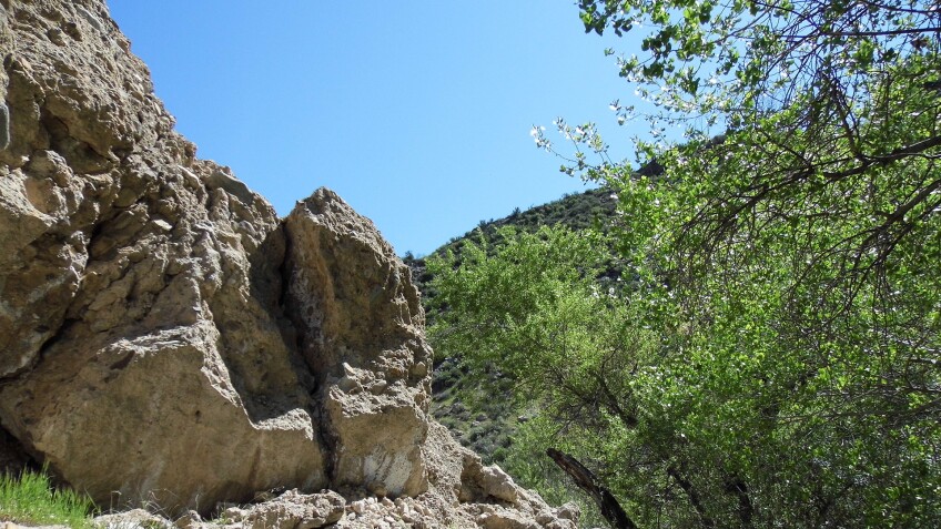
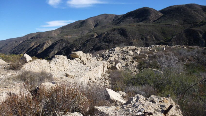
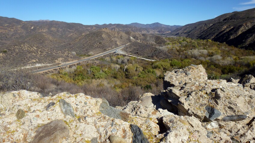
The remains of William Mulholland's career-ending engineering failure, however, can be found if you know where to go – a short walk down the closed portion of San Francisquito Canyon Road, north of Santa Clarita in the Angeles National Forest. Climb down to the pile of concrete rubble from when the last standing piece of the broken dam was dynamited, or climb up to the top of the western abutment and walk on top of the concrete wall built into the hillside. From above, you get a good view of where the dam once stood in 1928, and the scars left behind by the 250-foot wall of water that rushed down the canyon, taking everything with it. Or, hunt for pieces of the broken dam that were deposited a couple of miles down by the flow of water.
In May 2019, the area was officially designated a national monument – which means that now there’s some federal funding to build a visitor’s center, install some interpretive signage, and actually protect what’s left of the ruins. In the meantime, you can visit the historical signage at LADWP’s Power Plant #2 (32400 San Francisquito Canyon Road, Santa Clarita) and the memorial plaque inside the parking area just south of the power plant. The Santa Clarita Valley Historical Society also hosts annual tours of the dam site and the flood zone in April, around the anniversary of the dam break.

More from SoCal Wanderer

2. Mulholland Dam at the Hollywood Reservoir, Lake Hollywood
Like the St. Francis Dam, the Hollywood Reservoir dam was designed by William Mulholland on behalf of the Bureau of Water Works and Supply, the predecessor to today’s Department of Water and Power. Frighteningly, the design that had been completed in 1924 and dedicated in 1925 was nearly identical to the St. Francis Dam – a concrete-arched gravity dam. So, in the wake of that catastrophic break, Mulholland ordered the Weid Canyon Dam (subsequently known as the “Hollywood Dam” and the “Mulholland Dam”) to be lowered. In theory, that would relieve the pressure and mitigate the risk of another tragic break.
But what the Mulholland Dam had going for it was a better, more stable location. And it still stands to this day, over a century later. But the St. Francis Dam disaster was such a black mark on the LADWP that the agency enshrouded the once-exposed monument to water in landscaping and fencing, hiding it from public view (and worry). After all, this dam was square in the middle of a densely populated metropolis. For this dam to fail was even more unthinkable than the unfathomable failure of the St. Francis Dam.
But the Mulholland Dam didn’t stay a secret. The surrounding parkland is now managed by the L.A. Department of Recreation and Parks and is open to the public. Try parking at the East Gate, one of three entrances to the walkway/bike path that gives you a good view of the surprisingly lush lake. The east side pathway leads you to the south of the reservoir, Hollywood Sign hovering behind you, and the Mulholland Dam looming in the distance. The dam is where the walkway continues past the Weidlake Gate and 933 feet all the way across the concrete structure that crosses Weid Canyon.


3. Hansen Dam, Lake View Terrace
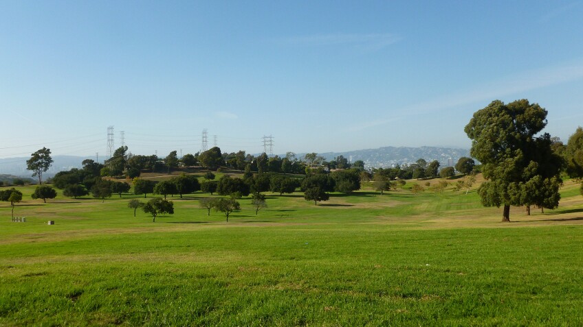
It may be hard to believe now, but flooding was once a major concern in the L.A. area. After L.A.’s catastrophic floods of 1938, nearly 1,000 men built the massive horseshoe-shaped Hansen Dam at the foot of the Angeles National Forest, near the confluence of Big Tujunga Wash and Little Tujunga Creek. Named after Homer and Marie Hansen – whose local horse ranch was seized by eminent domain for the dam’s construction – it was the largest of its kind in the world when it was completed in 1940. It was also the crowning glory of the U.S. Army Corps of Engineers’ flood control project, which also included channelizing the verdant Los Angeles River and all other major rivers, streams and washes.
Rising high above the bridle trails to the north and the golf course to the south, the monumental dam’s earthen wall doesn't actually stop the water from flowing. It merely slows it down to prevent another flooding catastrophe. Horses and their riders sometimes sink into the resulting quicksand below. But whether or not there's any flowing water to be slowed down, this engineering marvel is both beautiful to look at and a good spot to take in the surroundings, offering panoramic views of the North San Fernando Valley.
The Hansen Dam Recreation Area includes the dam itself and surrounding park facilities, all of which are managed by the Los Angeles Department of Parks and Recreation. You can access the parking lot and adjacent ranger station near the intersection of Osborne Street and Dronfield Avenue.


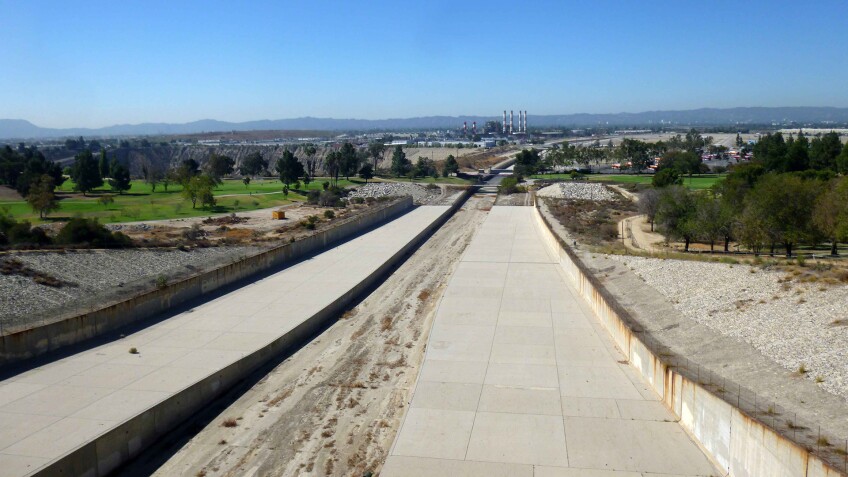
4. Lower Van Norman Dam at the Los Angeles Reservoir, Sylmar
Now known as the Los Angeles Reservoir Complex, a huge basin area in the Sylmar/Granada Hills region, not far from The Cascades, used to house the San Fernando Reservoirs. The rebuilt, current reservoir – an outstanding civil engineering achievement, circa 1977 – is the part of the Los Angeles Aqueduct system where filtered, potable water can either be gravity-fed out to drinking consumers or stored in a concrete-walled, 176-acre, 3.3 billion gallon reservoir.
This was the site of the former Lower Van Norman Dam, named after Harvey Arthur Van Norman, a William Mulholland employee and friend. It nearly collapsed entirely in the wake of the 1971 Sylmar earthquake, causing closure of the 5 Freeway and massive evacuations of those households downstream from potentially 1.8 billion gallons of drinking water. (At the time, it was only half full.) Aftershocks caused the partially liquefied earthen dam to crumble further. Fortunately, agency officials had known that the 1,100-foot dam had to be fixed and had already built a backup reservoir to handle overflow, just in case. Turns out they did indeed need it, as water levels needed to be lowered before they breached the top of the sinking dam.
Just in case there's ever too much water, each side of the reservoir also features a spillway, leading to a canal-like drainage trench below. But most of the water is both cleaned (via an Ultraviolet Disinfection Facility, the largest of its kind west of the Mississippi) and used. The water that comes into the L.A. Reservoir has actually already been purified at another filtration facility up the road, which receives water from The Cascades. The UV plant simply purifies it further, reducing the use of chlorine and other chemicals.
The water stored here is owned and managed by the L.A. Department of Water and Power, which sometimes opens it to the public for visits as part of its “Reservoir Walks” series. To be notified of future walks (which also visit Lake Hollywood and Silverlake Reservoir), sign up for the newsletter at the LADWP community news website or email communityrelations@ladwp.com.


5. Baldwin Hills Reservoir at Kenneth Hahn State Recreation Area, Baldwin Hills

Kenneth Hahn State Recreation Area is a large community park in the Baldwin Hills area of Los Angeles, named after former Los Angeles County Supervisor Kenneth Hahn and currently operated by Los Angeles County Parks and Recreation. A large portion of it is comprised of the filled-in basin of the former Baldwin Hills Reservoir, which was built between 1947 and 1951 and which failed in 1963. The empty “bowl” of the reservoir is visible in a grassy depression known as Janice's Green Valley.
The 338-acre park is what survives of another LADWP reservoir and dam, built upon hills that had been formed by uplift from seismic activity along the Newport-Inglewood fault. This was the same fault that triggered the catastrophic 1933 Long Beach earthquake. But its location directly on top of an active fault line – hollowed out of the north slopes of Baldwin Hills – wasn’t its biggest risk factor for failure.
See, land developer "Lucky" Baldwin had struck crude oil in the area in 1924 – and subsequent operations on the Inglewood Oil Fieldcaused disturbances in the Pliocene- and Pleistocene-era marine sediments that formed the foundation of the dam and reservoir. Ground faulting and fault creep had already been happening when, in the mid-1950s, water was injected into the fields to get more oil. The more oil that was extracted, the more the ground sank, by as much as 12 feet. None of the oil companies or the LADWP knew it at the time, but engineers later discovered that those methods of oil extraction – and the resulting subsidence – would cause the dam lining to fail. The reservoir was doomed.
One afternoon in December 1963, signs of lining failure – namely, a gurgling noise – were followed by leakage through the dam’s east abutment. It was slow enough to draw crowds and even a KTLA chopper news team – and the television coverage had plenty of time to alert local residents to evacuate before the dam breached, three hours later. The reservoir completely emptied, releasing nearly 250 million gallons of water in a 50-foot wall that washed away hundreds of homes and killed five people. The dam was never rebuilt and the reservoir never refilled with water – only with earth for the park that exists there today, which opened in 1984. For the easiest access point to the former dam site, head to the upper park parking lot (by the restrooms) and walk the “Bowl Loop”) around the basin. There is a fee to enter on weekends and holidays only.

Bonus: Old Bear Valley Dam, Big Bear Lake
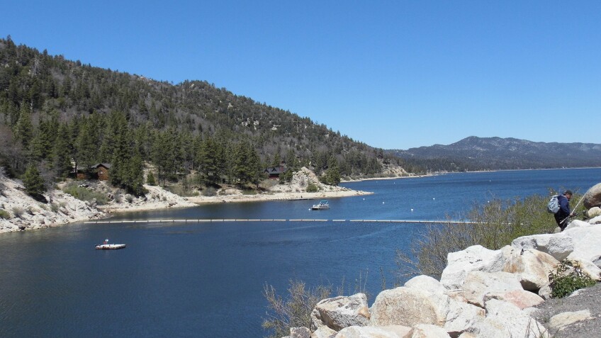
Big Bear Lake became the world's largest man-made lake when it was formed by the construction of a single-arch rock dam in 1884. Its water was brought down from the mountains to irrigate the citrus groves of the agricultural town site of Redlands. With increasing water demands, a new dam replaced the old one in 1912 – just 200 feet to the west and 20 feet higher, enough for the replacement dam to triple the capacity of the lake.
Nowadays, when the lake’s water levels are high, The Old Bear Valley Dam is submerged underwater – but it’s there, marked by a historical plaque near the juncture of Big Bear Boulevard and North Shore Drive. It’s still managed by Big Bear Municipal Water District, which maintains Big Bear Lake for recreation and wildlife. About 3/10 of a mile east down Big Bear Boulevard (a.k.a. State Highway 18) from the dam, look for the granite ruins of the former dam keeper’s house (circa 1890), located on the south side. Several dam keepers and their families occupied this rock house until as recently as 1977.
For information on Devil’s Gate Dam, see the article “Where to Explore Iconic 'Devilish' Places in SoCal.”


