Road Notes: Tioga in Yosemite to Reopen, PCH Fully Reopened & More
As summer approaches, roads closed by winter-related reasons are starting to open. A number of recent announcements have been especially good news for those who want to head over to some of Cailfornia's more popular outdoors spots. Here are five briefs:
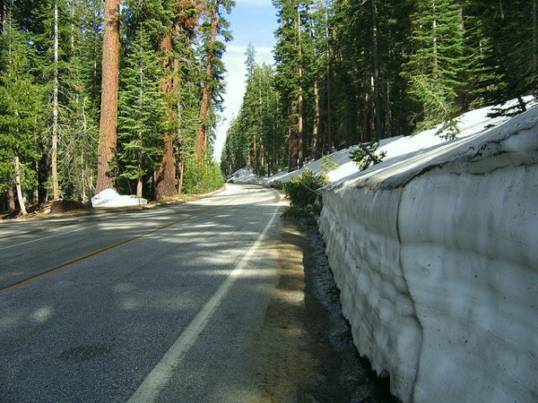
Yosemite National Park, Glacier Point & Tioga Roads: There two main roads in the park that close due to snow, and the public keenly awaits their opening. One of them, Glacier Point, reopened on May 27th. The other, Tioga, is a key east-west crossing over the Sierra Madre mountains and will open Saturday, June 18 at 8:00 a.m. for all vehicle traffic. That said, with lots of snow yet to melt, there are several no-stopping zones, hiking is extremely limited and all campgrounds along the artery remain closed.
Central Coast, Pacific Coast Highway: A landslide some 40 miles south of Big Sur closed Highway 1 in both directions on April 14th. Last Thursday it was reopened, but take note as there are still various projects along the Central Coast route where you'll encounter some single-lane portions controlled by traffic signals.
San Bernardino Mountains, Highway 330: The 15-mile highway that heads into the San Bernardino National Forest from the Inland Empire was closed in December by washouts and mudslides. The artery is currently only open a few hours a day for commuters, but officials will fully reopen it this Friday afternoon. Caltrans officials, however, warned drivers to expect some flagging or possible partial and full closures as repairs are finalized over the summer.
Big Bear Lake, Highways 18 and 38: A 100-year-old bridge is being replaced over Big Bear Dam, which is located where the 18 and 38 highways meet. Slated to open Friday, June 24th, the $39 million bridge, which is below the old bridge, has three lanes (instead of two), eight-foot shoulders and a pedestrian walkway.
Mammoth Lakes Basin, Various Roads: Inyo National Forest officials opened access roads to the basin on Saturday, but cautioned that "above average snowpack has left tall walls of snow, narrow roads, and limited parking." That means drivers, cyclists and hikers should be extra courteous when sharing the road. Most all lakes in the area are accessible, save for Horseshoe Lake, which is plowed one-mile shy of the lake. While Twin Lakes are snow and ice free, all others are still covered with snow and ice, according to forest officials.
Say hello: "Like" SoCal Wanderer on Facebook and follow us on Twitter to talk about latest in outdoors with other enthusiasts.
The photo used on this post is by Flickr user Dawn Endico. It was used under a Creative Commons License.


