Six Easy, Lesser-Known Excursions at Anza-Borrego

Please explore responsibly. While "SoCal Wanderer" continues to uncover the region’s local gems and not-to-miss destinations, these are uncertain times with public health guidelines changing constantly. We encourage our readers to stay curious and cautious.
One of the lesser-known desert jewels of Southern California is located in East San Diego County, smack dab in the middle of the Colorado Desert — Anza-Borrego.
While the Anza-Borrego Desert Region extends all the way to the Imperial Valley and even down to the Mexican border, its best-defined boundaries are within Anza-Borrego Desert State Park.
Formerly known as "Borego Palms Desert State Park" (with the misspelling of the Spanish word "borrego," meaning lamb) and simply Anza Desert State Park in the 1930s, it's not only California's first desert park, it's also our largest state park!
And that means there's plenty of room for the local peninsular bighorn sheep to roam — and plenty of areas for visitors to explore.
Officially designated Anza-Borrego Desert State Park since 1957, it's so big, it can intimidate tourists — which is maybe why so many of them flock to the same popular but well-worn destinations like the Borrego Palm Canyon Trail instead of venturing out to more far-flung locations.
But the Anza-Borrego area is so rich with history, biodiversity and geologic gems.
To only come for the wildflowers near town — as people began to do as early as the 1930s — would be to miss out on the many reasons why California began acquiring parcels of private and federally-owned land in 1932 to form this crown jewel of its newly-formed state park system, and why UNESCO has included it in its World Network of Biosphere Reserves.
So, if you're ready to tackle the rugged landscape like a true pioneer, pack your park map and the rest of your desert survival guide essentials, and get ready to experience the historic scenery of this desert sanctuary via these six beginner excursions.
1. Great Southern Overland Stagecoach Route of 1849 (S-2 between Scissors Crossing and Mesquite Oasis)

This first excursion isn't a hike or even a walk — though it affords you plenty of opportunity to do both as you explore. Instead, it's a drive along the historic route of the Great Southern Overland Stagecoach, circa 1849, which followed the path of the Southern Emigrant Trail. Although the stagecoach line once went much farther than the official designation along San Diego County Route S-2, this 30-mile stretch in present-day Anza-Borrego offers plenty of reasons to pull over — including historical markers, interpretive signage and even some structures.
Start your journey in the San Felipe Valley at the intersection known to locals as "Scissors Crossing" — where the S-2 crosses Highway 78 in a zigzag fashion. On the north side of the 78, directly across from where the S-2 becomes the Great Southern Overland Stagecoach Route, you'll find a marker for the Vallecito-Butterfield Stage Station. The Butterfield Overland Mail stage station — a.k.a. the Historic Vallecito Stage Station — isn't actually located at this spot, but nearly 19 miles south at Vallecito County Park. The park is open Labor Day Weekend to Memorial Day Weekend for primitive camping — or for day use (for a fee) to check out the station, which was reconstructed in the 1930s using original building materials.
Along the way, about halfway between the Vallecito marker and county park, pull over in the turnout and walk up a stair to read a historical plaque commemorating how the Mormon Battalion carved a wagon road through the high, rocky walls of Box Canyon in 1847 — which literally cleared the way for the stagecoach to pass through this otherwise uninviting section of Southern California. Box Canyon also offers access to a section of the California Riding and Hiking Trail, if you're interested in exploring on foot.
Other manageable points of interest to visit along this historic route include the unpaved Old Overland Stage Route turnoff at June Wash and the Stagecoach Trails Horse Camp & RV, where you can stock up on supplies at the General Store or even rent a cabin, RV hookup or campsite for the night.
2. Juan Bautista De Anza National Historic Trail Auto Tour Route (Highway 78 and Yaqui Pass Road)

The Juan Bautista de Anza Expedition of 1772 followed the Portolá expedition as part of Spain's efforts to colonize "New Spain" — traveling from Mexico to the San Francisco Bay in Alta California and passing right through what's now Anza-Borrego Desert State Park (Juan Bautista de Anza himself being the park's namesake). There are several Anza Trail historic sites throughout San Diego County and the Anza-Borrego area that are part of the Juan Bautista de Anza National Historic Trail — and you can drive along his historic path on Highway 78, starting with its juncture with Highway 86 in Imperial County to the east (just past the San Felipe Wash) and turning off onto Yaqui Pass Road (a.k.a. S-3) to the west.
About 1.5 miles east of the Ocotillo Airport in Ocotillo Wells, look for the Los Puertecitos Historical Marker near the spot where the 240 members of Anza's expedition party camped out in the "little passes" more or less following the San Felipe Wash. You can further explore their route on an off-highway vehicle at the Ocotillo Wells State Vehicular Recreation Area, as the Wash crosses several of the park's ATV trails, between the areas of "C" Hill and Hidden Valley Camp and Holmes Camp and Barrel Springs.


Proceed 17 miles west down Highway 78 to Yaqui Pass Road (first paved in 1942), where the Auto Route turns right (north) and follows San Diego County Highway S-3 north into the town of Borrego Springs. You can get out of your car and explore on foot at the 1.5-mile Yaqui Well Trail across from the Tamarisk Grove Campground, the 1-mile Bill Kenyon Overlook Trail just two miles up the Yaqui Pass, and throughout the Ricardo Breceda sculptures of Galleta Meadows, where the S-3 turns left onto Borrego Springs Road.
Finally, you can visit two former Anza Expedition campsites just northwest of the town of Borrego Springs — El Vado in Coyote Canyon and Santa Catarina Springs (4WD required).
3. Kumeyaay Village Site (Highway 78 at Mine Wash, Pinyon Mountains)

From the Mine Wash turnoff off Highway 78 — about three miles east of the juncture with Yaqui Pass Road (in the Mescal Bajada region of the Pinyon Mountains) — you can drive about 1.5 miles down a jeep trail to reach an 8.4-acre cultural site once inhabited by members of the Kumeyaay tribe as long as 1,100 or 1,200 years ago and as recently as about 400 years ago. Pass the primitive restroom on the right, and park your car in the wide, sandy turnout at the end of the jeep trail, where you can walk the undefined — but mostly flat and loose — paths throughout the site.
Among the boulders that provided shelter for the Kumeyaay villagers, you'll spot some of the ancient food sources they gathered — cacti, yucca and agave, plus ocotillo, chia and grasses — as well as where they milled and ground seeds and other foodstuffs into the bedrock to prepare them for eating. These holes (mortars, or morteros) and other depressions (metates) can be found on low, flat boulders throughout the site.

In addition to these food-processing sites, some of these boulders also contain an ancient rock art form related to petroglyphs, known as "cupules" — formed by hammering stone onto stone, likely as part of a ritual. You might find hundreds of cupules on one rock alone at the Mine Wash Village Site.
Note that according to the Archaeological Resources Protection Act of 1979, you may enjoy this sensitive archaeological area, but you must not deface or remove any historic or prehistoric object. So, leave only footprints, take only photos and leave your dogs at home.
4. Narrows Earth Trail (Highway 78 in Powder Dump Wash)

About two miles east of the Mine Wash turnoff in the Highway 78 Corridor, and four miles west of the highway's juncture at Borrego Springs Road, look for a sign for the Narrows Earth Trail — one of a handful of nature trails in Anza-Borrego Desert
State Park with interpretive signage and free printed guides available at the trailhead. Pull over in the wide turnout on either side of the 78 (known as "Julian-Kane Springs Road" when it opened in 1925), noting that the trail is located on the south side if you'd rather avoid scuttling across the highway on foot.
While the Narrows Earth loop only clocks in at about a half-mile, it isn't short on fascinating scenery or dense history both in terms of its geologic record and its land use. Highlights along the trail include speckled granite deposits that started forming millions of years ago, visible earthquake fault line fractures in the canyon walls and traces of when this area was submerged under an ancient sea.


The surrounding area got its name "Powder Dump Wash" from road crews in the 1930s. While there's a separate Powder Dump Wash hike directly east of the Narrows Earth trailhead, you can see the concrete remains of a bunker once used to store explosives on the east wall of the canyon (at stop #2 on the numbered interpretive trail).
Because this hike is flat and brief, it's one you can do pretty much all year long. Beware when there's rainfall, as these washes are located at the bottom of Sunset Mountain and in the "narrows" section of the San Felipe Creek and can get pretty wet, pretty quick. There are no restrooms at Narrows Earth and dogs aren't allowed on any trails or in any wilderness areas in the park.
5. Slot Canyon Overlook (Borrego Mountain Wash)
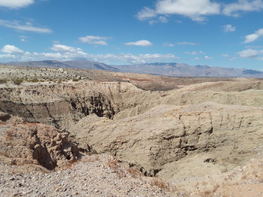
In the Borrego Mountain area of central Anza-Borrego Desert State Park, in the southernmost part of the Borrego Badlands, there's a popular two-mile trail through "The Slot" — a slot canyon made of narrow walls of siltstone. This steep trail may get a little crowded — especially with such narrow passage — but fortunately, there's a different way to enjoy this area for beginners and geology buffs alike.
Follow the dirt road known as Borrego Mountain Wash to the signed juncture at the turn-off to Hawk Canyon. Stay straight (or left) to continue the path to The Slot, parking in the large unpaved lot with primitive restroom facilities. Instead of climbing the ridge marked "The Slot" (which isn't that easy to find), cross the parking area and continue to follow Borrego Mountain Wash on foot, which will take you high above the Badlands and provide a breathtaking view. Go as far as you feel comfortable and return the way you came.
More experienced hikers can continue walking the dirt road to the trail for West Butte Summit, which forms a strenuous loop with the Slot Canyon Trail and brings you back to your car. Leave your pups at home for this one, too.
6. Elephant Tree Discovery Trail (Split Mountain Area at Alma Wash/Fish Creek)

Anza-Borrego is the only spot in California where the elephant tree (Bursera macrophylla) grows — making the one on the Elephant Tree Discovery Trail a major arboreal rarity. Although there is only a single specimen of this rare tree on this mile-long nature trail, you're guaranteed to see it — along with creosote, brittlebush, smoke trees, indigo bush, catclaw and desert lavender.
Take Split Mountain Road south for about 5.6 miles from Highway 78 in Ocotillo Wells and turn right when you see the large interpretive sign. The jeep trail leading to the trailhead and parking area can get a little gnarly — so while you don't necessarily need 4WD or AWD, you'll want to choose a vehicle with a little higher clearance so as not to tear up your underside. While navigating this unpaved road, take the path of least resistance whenever possible — even if that means driving on the wrong side of the road. Just take it slow, in case another vehicle is approaching you from the opposite direction.
At the trailhead, you'll find another interpretive sign describing just how rare the elephant tree is — so unusual, in fact, that a USDA official led a mini-expedition to it in 1937 just to prove that it actually existed! Pass the sign for "No Dogs on Trail" and follow the numbers along the path, starting with #1. It can be a little difficult to follow, as the entire area looks like one big wash — but if you take a long look down the trail instead of focusing on what's right in front of you, you'll find your way. Arrows on short, wooden pillars will help point the way between the numbered stops.

To see the elephant tree for yourself, you'll need to slog your way through the loose sand underfoot to stop #9. That's where the "last of its herd" has survived, although other elephant trees are found elsewhere in the park. Along the way, you'll see plenty of other examples of "desert survivor" plants, too (including prickly, spiny ones you'll want to keep your dogs away from by leaving them at home). Continue to stop #13 at the end, which will bring you back to the beginning of the trail.
According to the California Department of Parks and Recreation, the state requires you to wear a face covering when you cannot maintain a physical distance of six feet or more. Individuals must have a face covering with them at all times.
Check the park website for updated openings and closures.


