Where to Explore San Diego Outdoors (And Even Cool Off A Bit)

In the rest of Southern California, temperatures are reaching triple digits this time of year. But in San Diego, even if it's not exactly 72 and sunny every day, it can at least be a good 20 or 30 degrees cooler than it is farther north or farther inland.
And that makes California's second-largest city a top choice for visiting — or staycationing — during the summer.
In San Diego, you don't even have to hang around at the beach to stay cool. In fact, there's plenty of terrain to explore outdoors within city limits and just beyond — even all the way down to the Mexican border — without overheating.
Even some of San Diego's most popular outdoor spots have some lesser-known trails where you can cool off and avoid the crowds.
So, whether you're looking for a hidden gem in your own hometown or you're venturing to a new area, here are five of the most intriguing spots to stretch your legs in San Diego — without risking heat exhaustion (or worse)!
As always, drink plenty of fluids, wear sun protection and avoid times of day during peak sun and temperature highs. Seek shade and/or air conditioning after prolonged heat exposure.
1. Gunpowder Point, Chula Vista

Did you know that you could make gunpowder out of a type of algae harvested from California's abundant, underwater kelp forests? Well, not exactly gunpowder — but a "propellant" called cordite, which can be a low explosive (versus a bomb) but without all the smoke of traditional firearm ammunition.
During the supply shortages of World War I, that's exactly what happened at "Gunpowder Point," a 30-acre tideland now part of the San Diego Bay Sweetwater Marsh, a unit of the San Diego National Wildlife Refuge Complex adjacent to the San Diego Bay. There, kelp factory workers ground up nitrate-rich giant kelp (Macrocystis pyrifera), liquefied it and then fermented it to create "kelp liquor" — a precursor to a material called potash, which is used to make cordite.
Over 1,000 employees worked for The Hercules Powder Company, which was the biggest of the 11 California kelp companies in 1916 — and they arrived to work on the "Potash Special" trolley from the E Street station in Chula Vista (then known as "Potash Junction"). You can still see the trolley tracks inlaid in some remaining pavement.

After the seaweed processing plant closed in 1920, the area later transformed into the nation's largest cottonseed warehouse for refining oil products, owned by San Diego Oil Products Corporation. After a 1929 fire, the land reverted back to nature, shifting its focus from industrial to agricultural, including rows of tomato fields maintained by Cozza Farms and, later, the Samuel S. Vener Company/Venco Vegetables/Vener Farms. And, like many areas in Southern California, it made its way onto the silver screen — in the 1978 film "Attack of the Killer Tomatoes."
Park at the surface lot located on the corner of Bay Boulevard and E Street. Access the trails via a free shuttle offered by the Living Coast Discovery Center, currently only on Saturdays and Sundays from 10 a.m. to 5 p.m. After the shuttle drop-off, there's about a mile of walking along flat dirt and paved paths with no shade.
2. Cowles Mountain, San Carlos

Even late in the day, the trail up to Cowles Mountain in Mission Trails Regional Park can be lined with people, golden in the waning sunlight as the daytime temperature dips into dusk. At just three miles in length round-trip, it's a relatively short haul — especially for a steep, 900-foot elevation gain. That makes it a great training hike, happy hour hike or on-your-way home hike, making it generally more popular with locals than with tourists or other visitors. While the trail to Cowles Mountain Summit is both well-maintained and well-marked, watch out for trail-cutters taking shortcuts around the many switchbacks. Instead, follow proper trail etiquette and stick to the designated trails.
As you climb higher towards the 1,593-foot summit — the highest in the City of San Diego — you'll catch glimpses of nearby Lake Murray Reservoir and the rest of the huge open space that surrounds you. Mission Trails clocks in at nearly 8,000 acres — making it not only the third crown jewel of the San Diego Parks system, but also one of the largest urban parks in the country. (Compare to L.A.'s Griffith Park, which encompasses 4,210 acres and San Diego's Balboa Park, which is 1,200 acres.)

To extend your hike, continue past Cowles Summit and on to Pyle's Peak (to the left) or along the Big Rock Road Trail (to your right). Otherwise, head back down the way you came up or switch it up by descending the Barker Way Trail. There are several of these connecting trails throughout the park, which combined create 60 miles of hiking, so it's best to download an official trail map ahead of time rather than winging it upon your arrival.
Park in the surface lot just north of the intersection of Golfcrest Drive and Navajo Road, or park on either side of Golfcrest. There's a public restroom at the trailhead. Check online for updated COVID-19 safety protocols in San Diego parks and the status of San Diego city services and facilities.


3. Torrey Pines State Natural Reserve, Torrey Pines
Stretching out across 1,750 acres, the Torrey Pines State Natural Reserve includes eight miles of trails and 3,000 of the nation's rarest pine tree, the endemic but critically endangered Torrey pine (Pinus torreyana). While all hiking trails in the preserve are currently open, a good starter hike is the 0.75-mile Beach Trail — which starts out simply and gently in the Upper Reserve and takes you past some of the reserve's namesake trees. Other sites include a geological formation known as Red Butte, where the Beach Trail intersects with the Razor Point and Yucca Point, trails. The fragile condition of the bluffs and the cliffs makes it imperative that visitors stay on the designated trails and not wander off onto the dangerous cliffsides.
The Beach Trail delivers stunning views of the Pacific Ocean, through some lush vegetation, before taking you down a flight of stairs to Torrey Pines State Beach. Just be sure to time your beach excursion a minimum of two or three hours before or after high tide to maximize the width of sand available between the bottom of the cliffs and the water. As long as the tide isn't too high, you can walk south along the cliffs until you reach the landmark formation known as Flat Rock. There is a restroom near the trailhead. Note that this trail is generally closed for safety reasons in the event of rain.

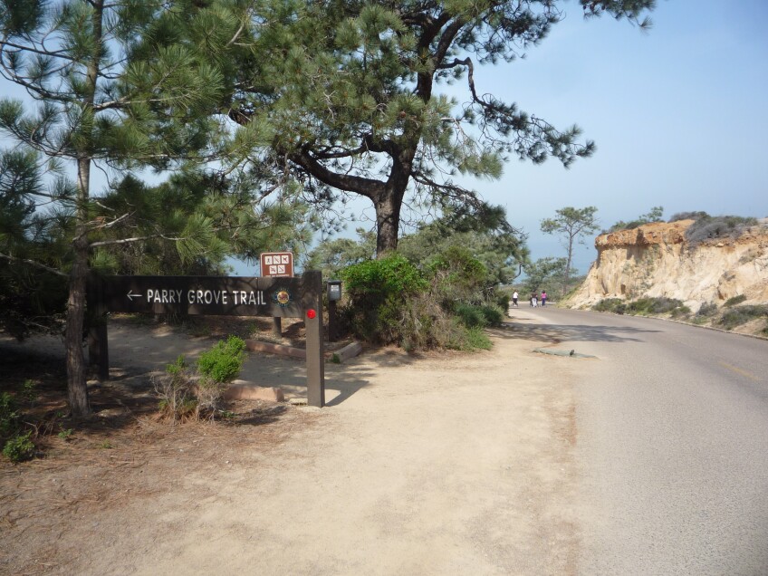
Another option is to stay in the reserve and get ocean vistas without going down to the beach — namely, by taking the Parry Grove Trail, a loop named after the man who introduced the Torrey pine to the scientific community, Dr. C.C. Parry. Although this nature trail is just a half-mile long from beginning to end, it's pretty steep going up and down 118 steps to get to it. It makes for a more secluded amble along one of the reserve's oldest trails — one of three plotted out by its first custodian, Guy Fleming, and renowned landscape architect Ralph Cornell. Enjoy the native California habitats of coastal sage scrub and maritime chaparral, including sand verbena, manzanita, California buckwheat, and even prickly pear cactus. Critters include lizards, beetles, harvester ants, bees, and perhaps even rattlesnakes.
Gates open daily at 7:15 am and close at sunset. Park in the South Lot by turning off North Torrey Pines Road (a.k.a. "Old Highway 101" or Highway S21) and traveling down Torrey Pines Park Road until you reach the security kiosk, where you'll pay a fee. If it's full, they'll redirect you to the North Lot off North Torrey Pines Road at McGonigle Road. You can also try to snag one of the free spots along the ocean-adjacent side of North Torrey Pines Road between lifeguard towers 2 and 4.
The visitor center and docent store are temporarily closed for COVID-19. Drinking fountains are also currently closed — and as there's nowhere to purchase food or beverages, be sure to bring your own drinking water. (Food may only be consumed on the beach, and not on the trails.) For a full list of reserve rules, click here.
4. Tijuana River National Estuarine Research Reserve, Imperial Beach

The largest coastal wetland in SoCal is located just north of the Mexican border at the Tijuana Estuary, where the Tijuana River meets the Pacific Ocean. You can explore its 2,293 acres of rare salt marsh along four miles of trails — for free — thanks to a partnership between California State Parks (in cooperation with the non-profit Southwest Wetlands Interpretive Association), the National Oceanic and Atmospheric Administration and U.S. Fish & Wildlife Service. Trails are open daily 7 a.m. to sunset.
While you're there (trails are open dawn to dusk), look for an endangered bird species known as the light-footed Ridgway's rail. To help guide your visit, pick up a bird identification brochure and/or trail map outside the Visitor Center front entrance at 3rd Street and Caspian Way. During open hours (Wednesday through Sunday from 10 a.m. to 5 p.m., as of June 23, 2021), the Visitor Center will also lend you a pair of binoculars for birdwatching. A public restroom is also available. Note that the center is closed on Mondays, Tuesdays and certain holidays (Thanksgiving, Christmas and New Year's Day).

The reserve also includes Border Field State Park in its southwest corner. It's currently closed to vehicular traffic during the week, but open to cars (for a fee) on weekends. Hikers, bicyclists and equestrians can access the park daily 9:30 a.m. to 7 p.m. except when it's closed for flooding. You can check current conditions on the California State Parks' website. Visit this state park for the nature — including several species of endangered birds — or for its early rancho history, including the former tourist destination known as Monument Mesa. (Friendship Park, located at the Mesa but operated by Border Control, is currently closed for COVID-19 restrictions.) Current rules and regulations can be found here.
5. Tijuana River Valley Regional Park, South Bay

The Tijuana River Valley Regional Park is more of a destination for a walk than a hike per se — especially the Bird and Butterfly Garden located at 2310 Hollister Street. True to its name, it's full of plants that attract our beautiful and sometimes elusive friends of the winged variety. Check out the interpretive signage so you know what you're looking at. Of course, this area is just a fraction of the 1,800-acre TRVRP and its 22.5 miles of multi-use trails — but it attracts as many as 340 bird species, thanks to its bird-friendly habitat (including plenty of water) and its position along the migratory route known as the Pacific Flyway.
Other attractions in the park include an overlook on the U.S. side of the Mexico border called Spooner's Mesa and a one-mile loop trail at Dairy Mart Ponds Ecological Reserve. This area (advertised as being in San Ysidro) used to be home to Dairy Mart Farms cooperative, which was formed in 1937 and closed in the 1970s. And the pond itself is a (flooded) relic of a defunct circa 1980s operation to mine sand and gravel — which was used as an aggregate material to make concrete and asphalt.

Thanks to its purchase by the Wildlife Conservation Board in 1988, Dairy Mart is now a popular birdwatching spot — with bird blinds and an overlook near the trailhead and a raised boardwalk to allow access even during flooding, all installed in 2012. Endangered species include the least Bell's vireo, the southwestern willow flycatcher and the light-footed clapper rail. Park in the staging area on Dairy Mart Road, near the juncture with Camino de la Plaza.
Open 8 a.m. to sunset, daily. Pedestrians may walk in as early as sunrise. No public vehicle access or restroom availability on Christmas Day (December 25). Rules and regulations can be found in the park brochure (click here for a digital version).


